
The 12-Day Manaslu Circuit Trek: Day-by-Day Detailed Itinerary
What is the Manaslu Circuit Trek?
The Manaslu Circuit Trek is a 12-day loop in the Himalayas of Nepal. The route circles Mount Manaslu, the eighth-highest mountain in the world, taking you directly through both the Manaslu Conservation Area and the Annapurna Conservation Area. It serves as a quieter, more remote alternative to the classic Annapurna Circuit.
Overview: Distance, Elevation, & Overall Difficulty
Total Trekking Distance: Approximately 130 to 170 km (80 to 95 miles) for the standard loop. This distance varies depending on your exact trailhead and optional side trips.
Maximum Altitude: 5,106 meters (16,752 feet) at the summit of the Larke La Pass.
Trek Duration: Usually 10 to 12 trekking days. The full itinerary requires 14 to 16 days once you factor in ground travel from Kathmandu. Adding the Tsum Valley side trip requires an extra 5 days.
Daily Hiking Time: Expect to walk for 6 to 8 hours daily, covering roughly 12 to 20 km each day. The longest day can take up to 12 hours.
The Manaslu Circuit is classified as a strenuous, high-altitude loop. It is entirely non-technical, meaning you do not need mountaineering gear like ropes, harnesses, or ice axes. The primary difficulty stems from cumulative physical fatigue, steep altitude gains, and basic teahouse infrastructure. Because it is a restricted region, you cannot trek independently. You must hire a licensed guide and secure group permits through an authorized agency.
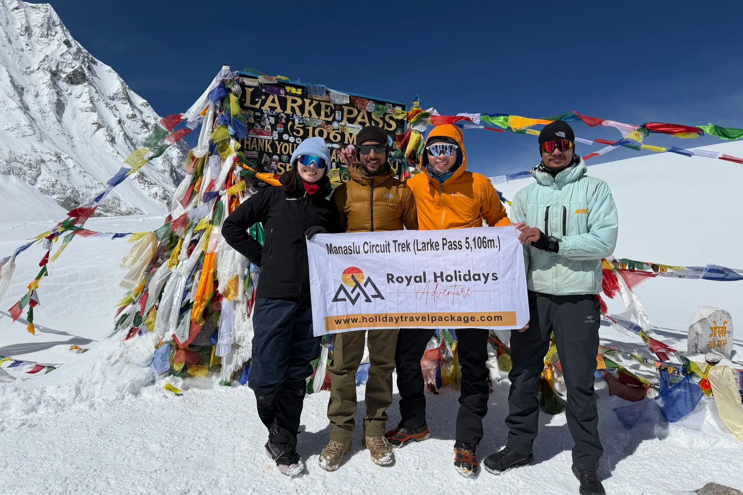
To manage our group permits, mountain safety, and evening health checks, we trekked the Manaslu Circuit with Royal Holidays Adventure, who handled our entire 12-day itinerary seamlessly.
we’ve partnered with Royal Holidays Adventure to bring you guys an exclusive discount on your next adventure! We are customers of Royal Holidays ourselves - they did a great job for us, and we wholeheartedly recommend them to everyone. Quote VIVKEV when booking your trek to save 5%. If you book through our code, we receive a small commission at zero extra cost to you. Thank you for supporting our adventures!
Our 12-Day Manaslu Circuit Detailed Itinerary Breakdown
Day 1: Kathmandu to Machhakhola (Jeep Day)
Estimated Travel Time: 7 to 8 hours
Logistics: Private Jeep or Local Bus
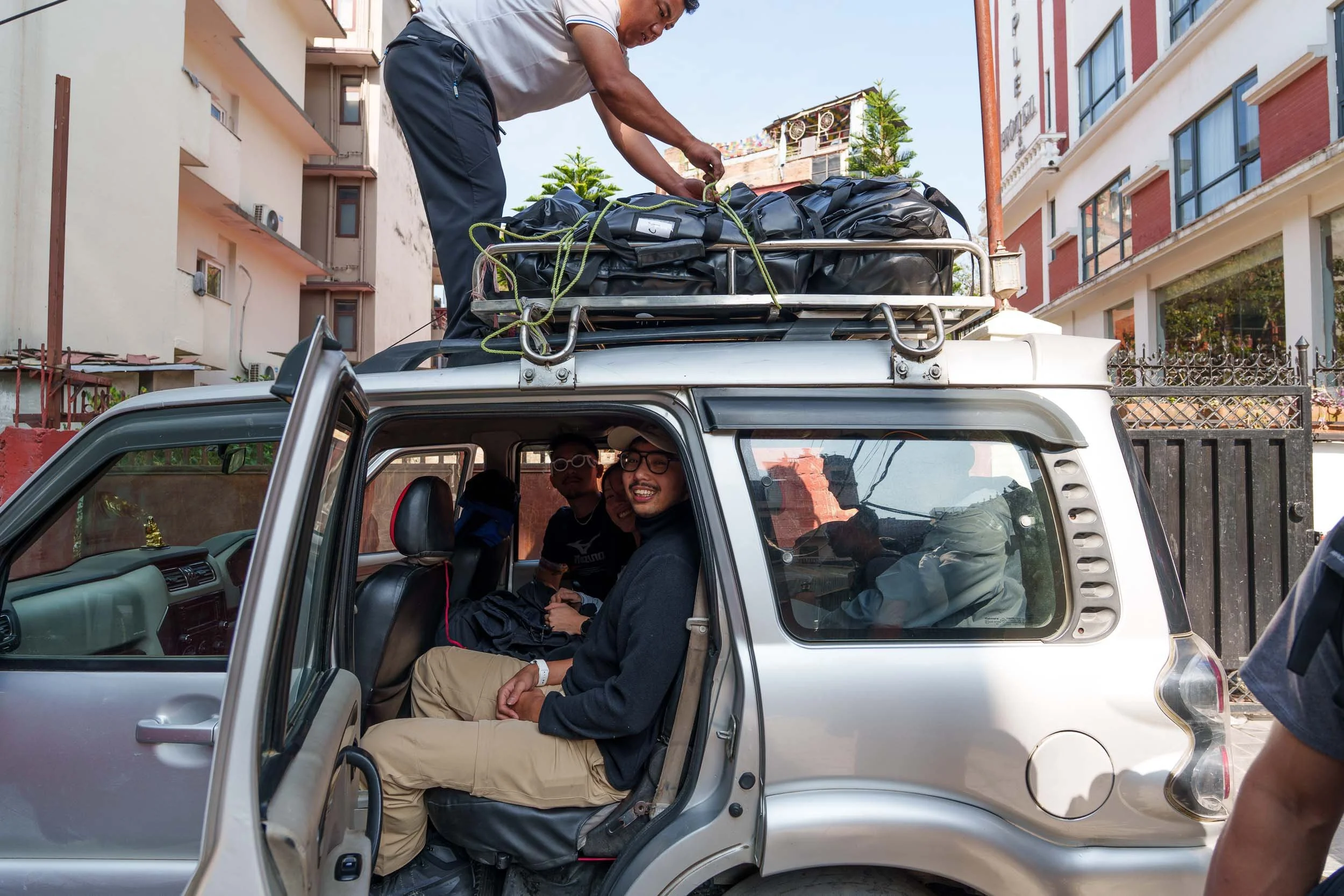
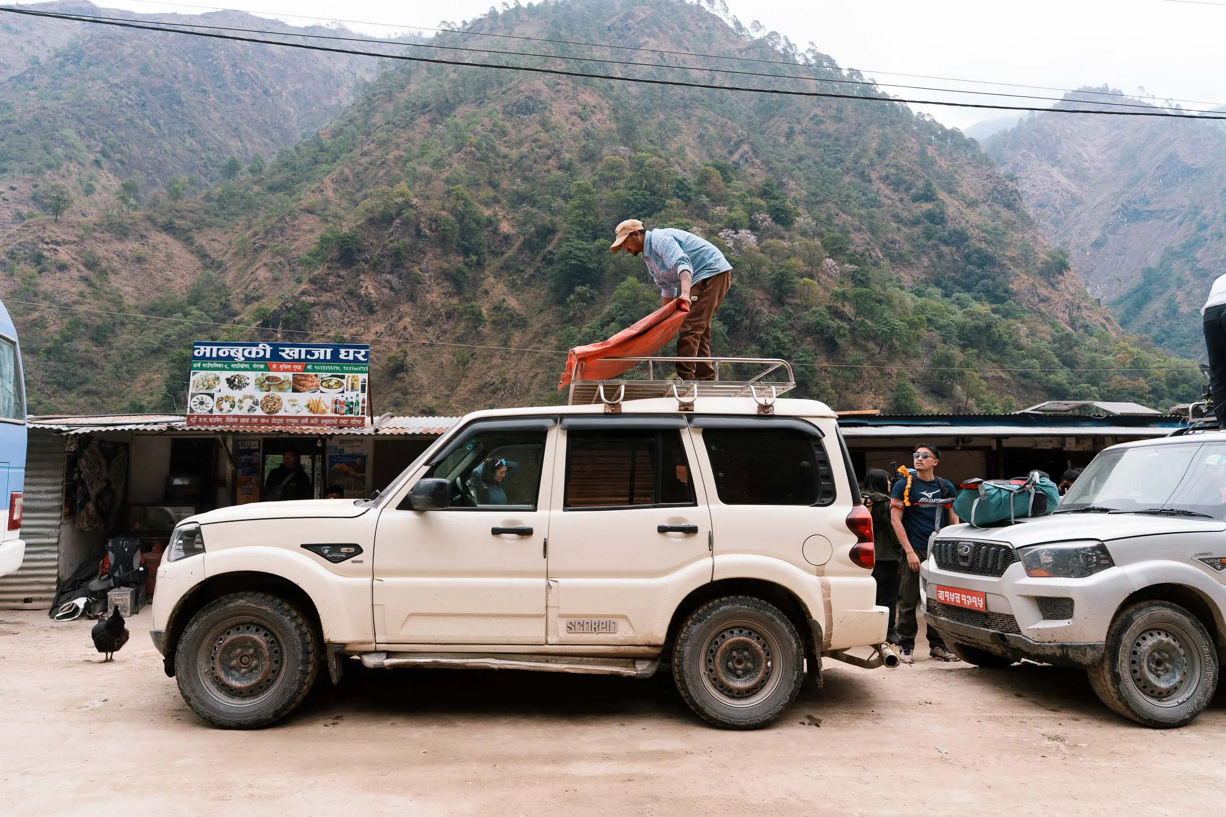
There are a few possible starting points for the Manaslu Circuit, but we began our journey in Machhakhola, which translates to Fish River in Nepali. To cover the roughly 160 km from Kathmandu, we had to set off early in the morning. Trekkers can either take a local bus for a more authentic, cheaper experience or hire a private jeep. Since we were traveling as a group of ten, we opted for a private jeep, which made the long journey a little more comfortable.
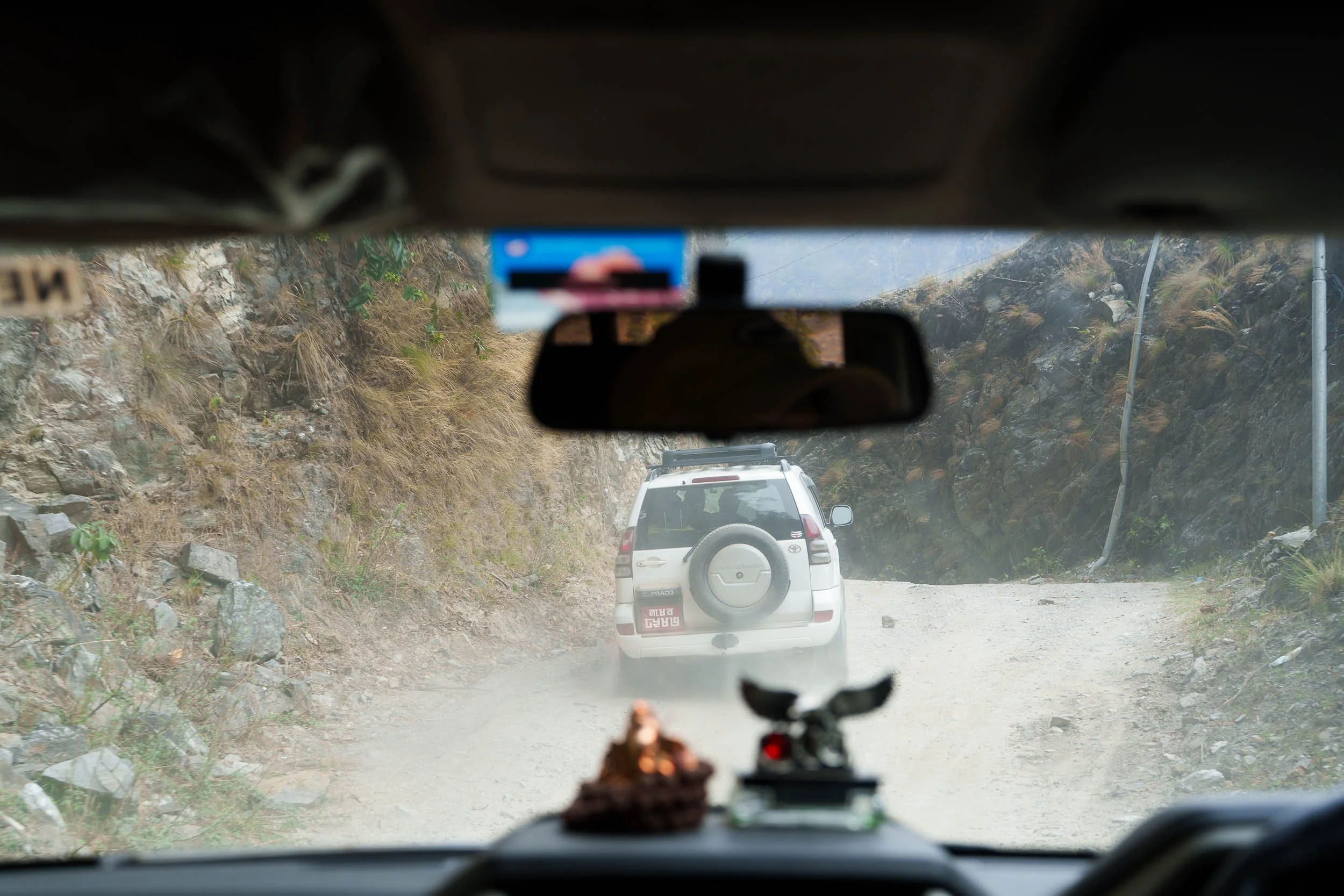
The first half of the drive is relatively smooth, but the second half introduces you to what many travelers jokingly call real Nepali roads, meaning rough, dusty dirt tracks that can be incredibly bumpy. We took motion sickness tablets beforehand and were very glad we did. It is worth considering if you are prone to feeling unwell on winding mountain roads. By late afternoon we arrived in Machhakhola, a lively riverside town with plenty of lodges, small shops, and teahouses where you can pick up any forgotten essentials before the real adventure begins.
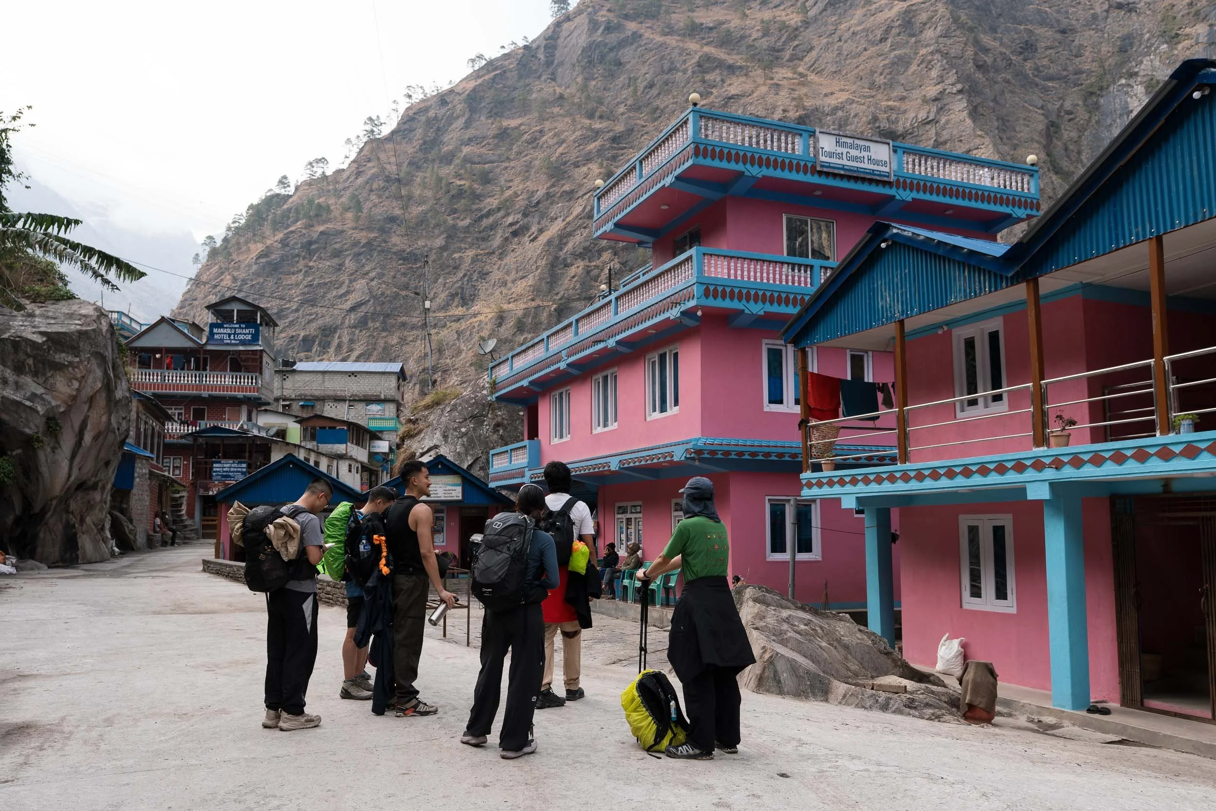
Day 2: Machhakhola to Jagat (1,330m / 4,363ft)
Hiking Distance: 16.8 km (10.4 miles)
Estimated Hiking Time: Around 8 hours
Elevation Gain: 710 m (2,329 feet)
Elevation Loss: 210 m (689 feet)
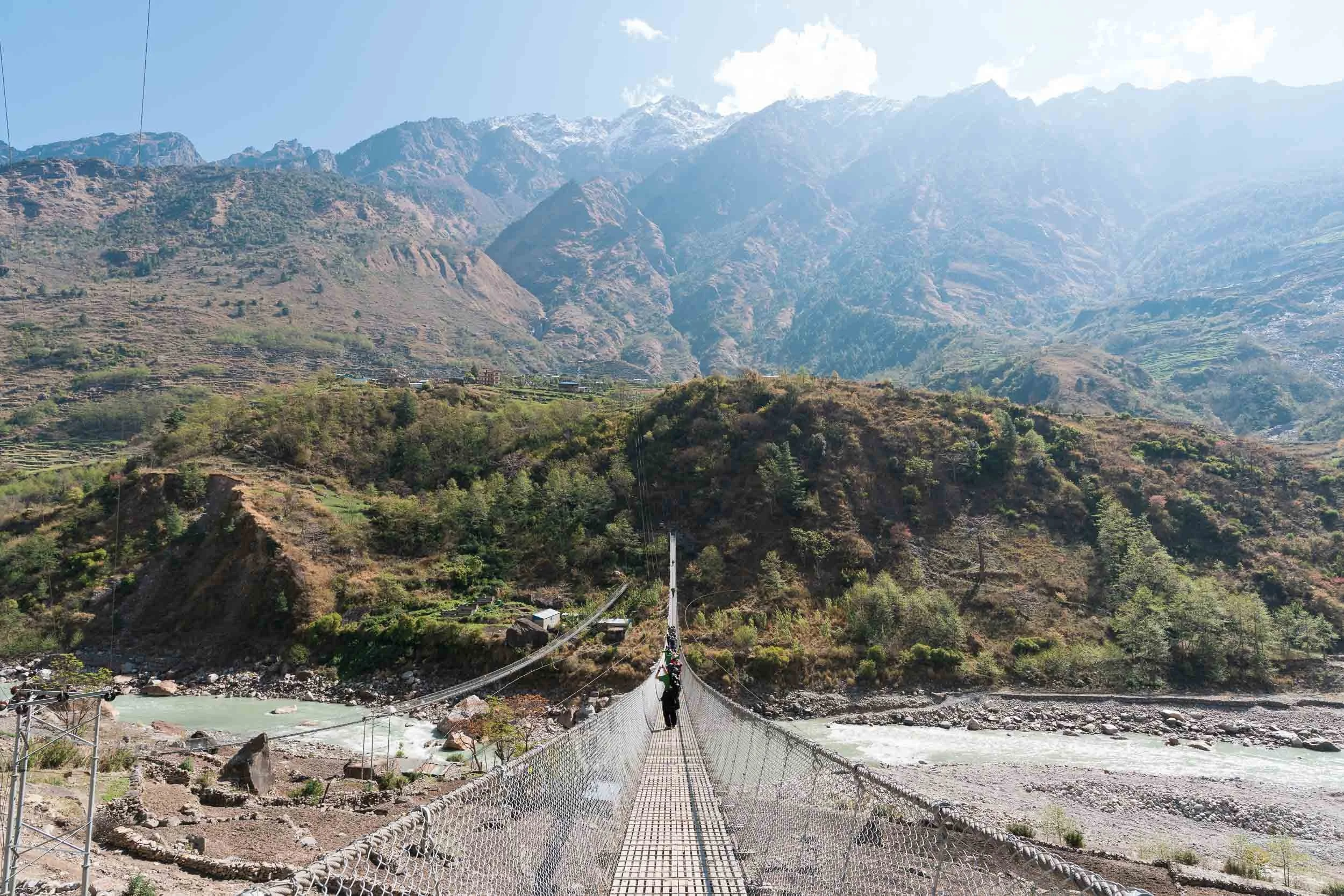
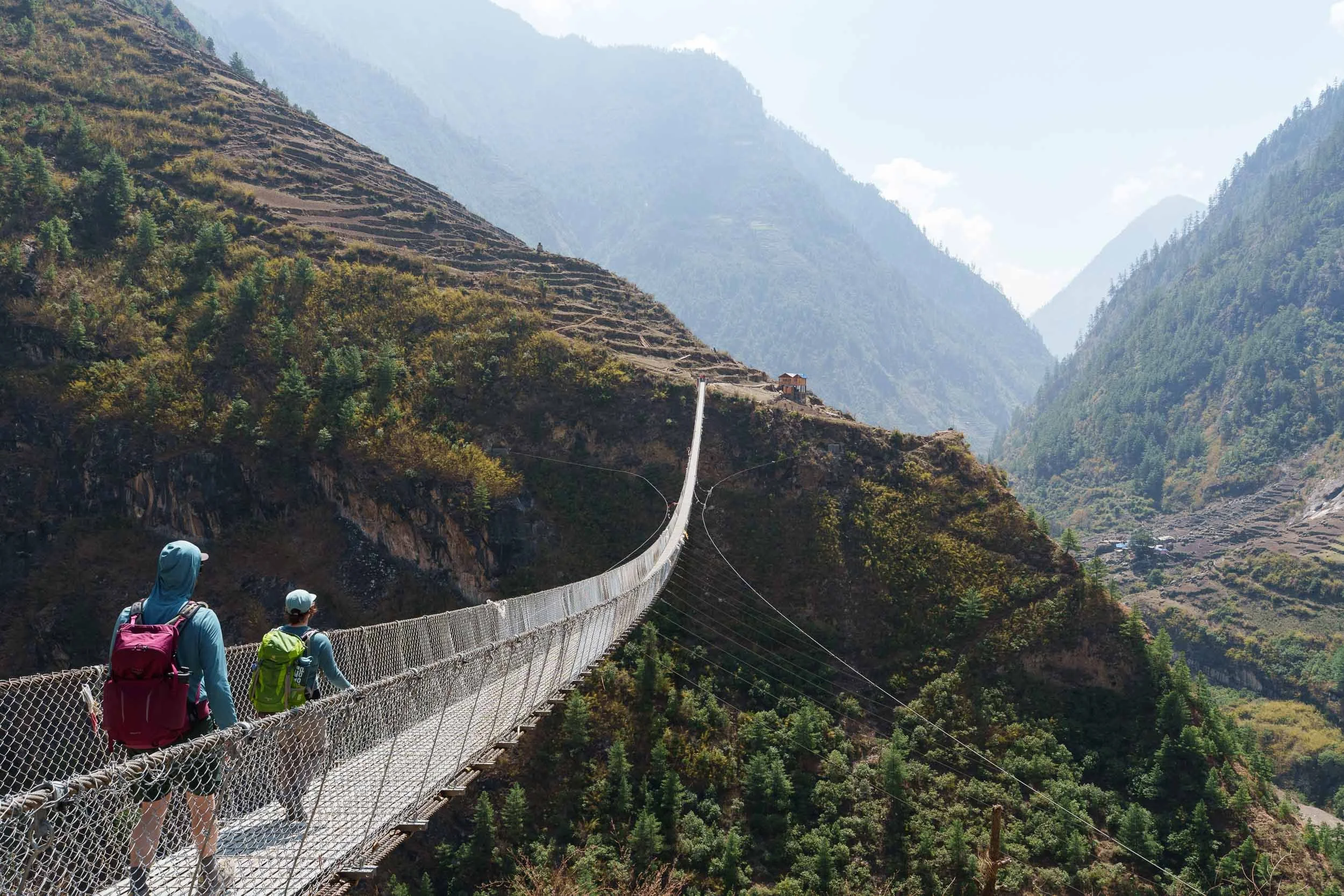
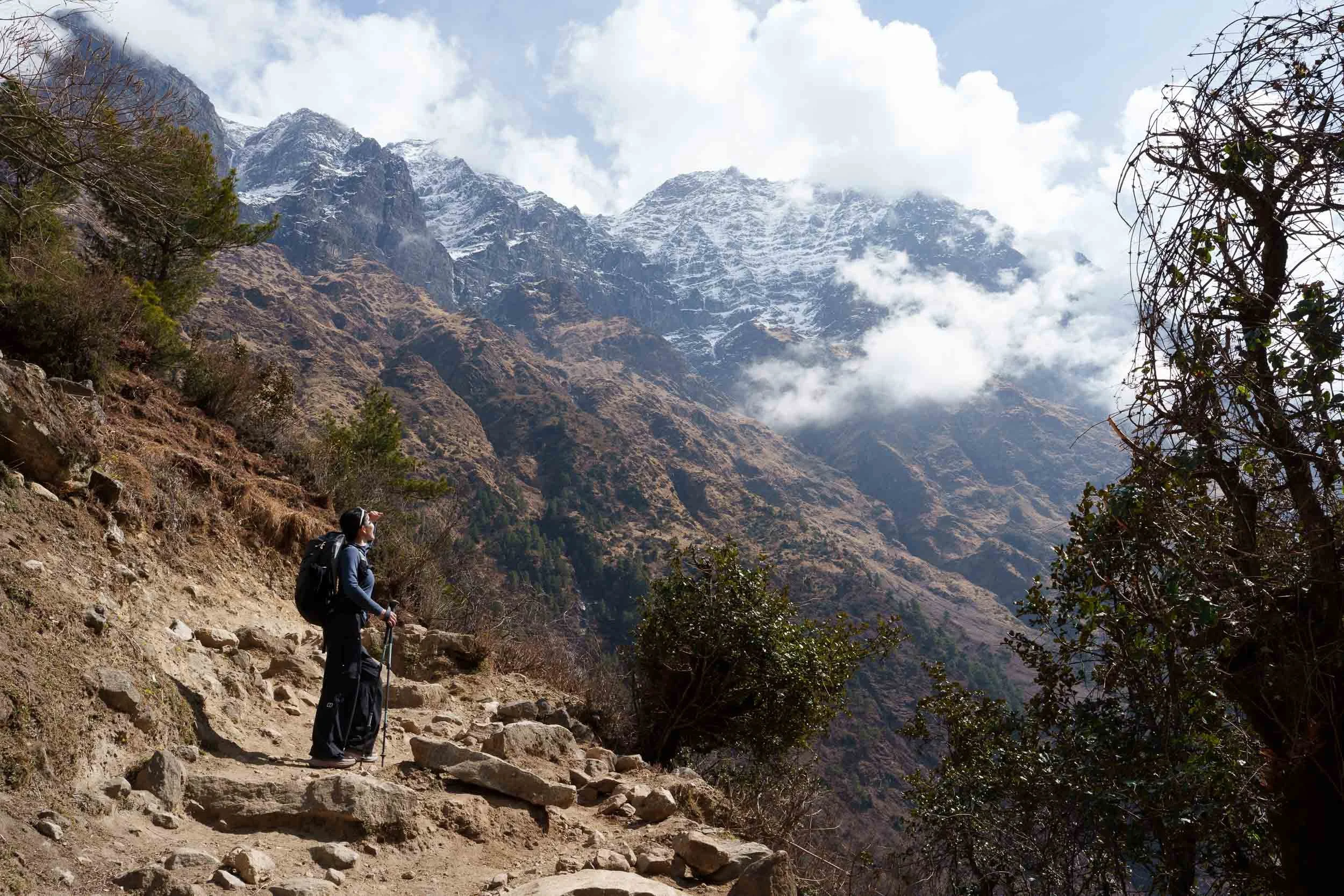
Our first day on the trail was also one of the longest. We left at around 9:00 am and did not arrive in Jagat until 4:00 pm. The first section follows a dirt road, but as the day progresses there are opportunities to leave the road behind and follow more traditional trekking paths. From the very beginning, the scenery is spectacular. We spent most of the day following the milky Budhi Gandaki River, crossing suspension bridges, passing waterfalls, and walking through small villages tucked into the valley.
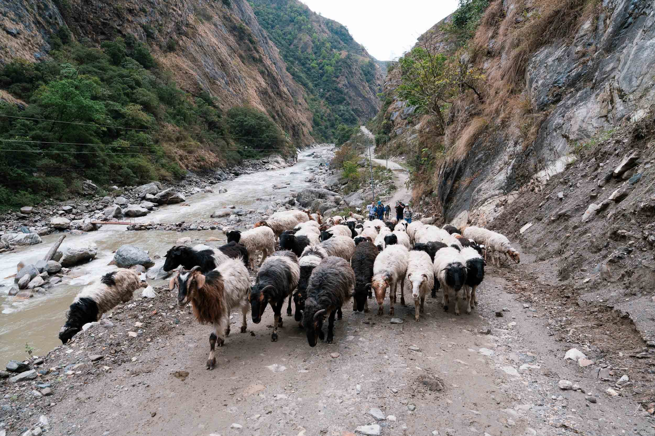
One of the highlights was passing Tatopani, home to natural hot springs. Although we visited during spring when temperatures were already quite warm, these pools are especially popular during colder months. We also passed through Dobhan, where children in neat school uniforms walked alongside us on their way to class.
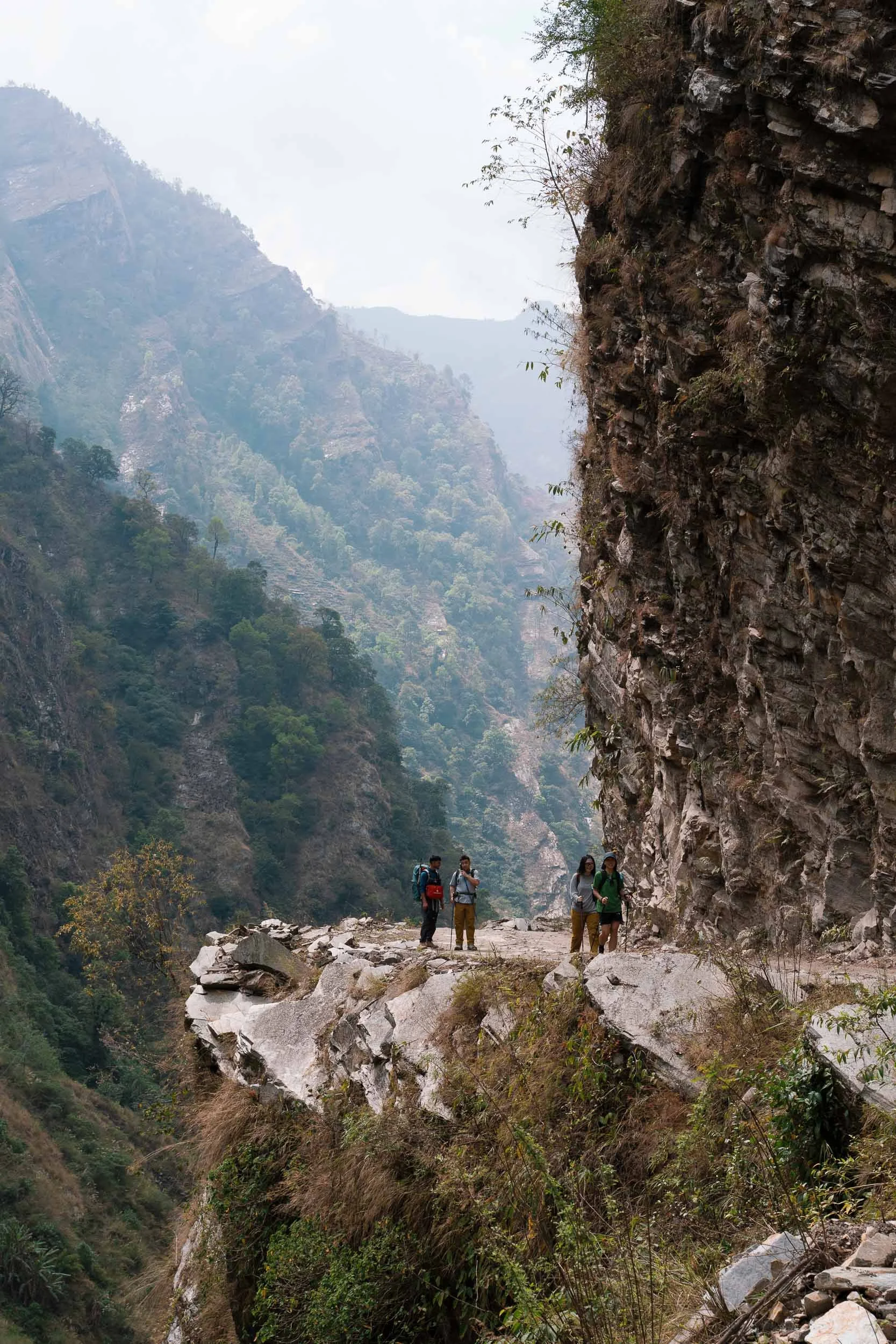
Many trekkers consider this one of the hardest days of the entire circuit. Not necessarily because of the elevation gain, but because our bodies were still adapting to carrying a pack and walking long distances. There are also a few narrow cliffside sections that may feel intimidating for those who are not fond of heights. Despite the challenge, it was an unforgettable introduction to the Manaslu region. Towering mountains rose on either side of the valley, making us feel tiny in comparison.
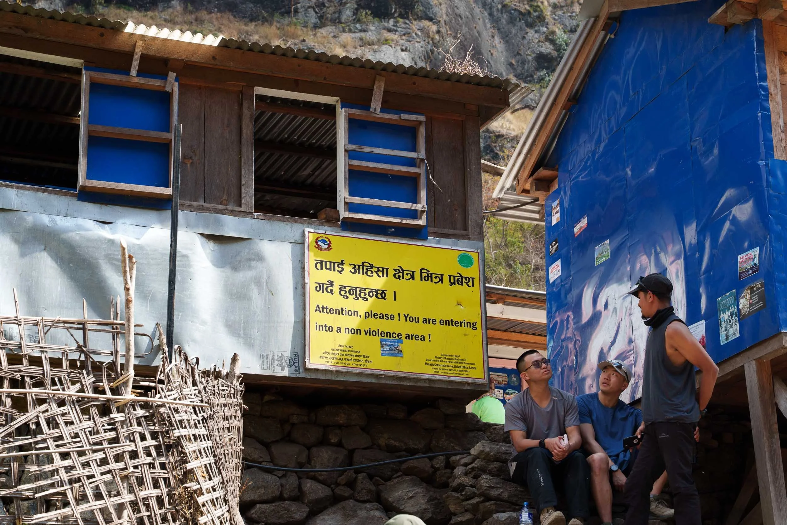
Jagat marks an important milestone on the trek. This is where the road effectively ends and where our passports and permits were checked before we officially entered the restricted Manaslu region. Another notable detail is that this would be our last realistic opportunity to eat meat. Beyond Jagat lies the Buddhist non-violence zone, where the slaughter of animals is forbidden.
Day 3: Jagat to Deng (1,870m / 6,135ft)
Hiking Distance: 18.7 km (11.6 miles)
Estimated Hiking Time: Around 9 hours
Elevation Gain: 910 m (2,985 feet)
Elevation Loss: 370 m (1,213 feet)
Day three continued along the Budhi Gandaki River, but the scenery began to change dramatically. We passed through a series of traditional Gurung and Magar villages, including Philim, Ekle Bhatti, and Nyak. If the weather is clear, this is often the first day trekkers catch sight of a snow-capped Himalayan peak rising above the valley walls.
One of our favorite parts of the day was walking through lush forests of bamboo and pine. The trail became quieter, greener, and more atmospheric, with sunlight filtering through the trees while the sound of the river echoed below. It felt like we were gradually leaving the lower hills behind and entering a wilder part of the Himalayas. The suspension bridges also became longer and more dramatic. With every turn, the mountains seemed to grow larger, creating the feeling that the valley stretched endlessly into the distance.
A significant moment came when we crossed into the Buddhist non-violence zone. The boundary is marked by a small yellow sign beside a small village and is surprisingly easy to miss. Yet culturally, it represents an important transition into sacred Buddhist land where animals cannot be slaughtered. Shortly afterwards, we arrived in Deng, a small Buddhist settlement tucked deep within the valley. Surrounded by towering mountains and snow-capped peaks in the distance, it was a peaceful place to spend the night.
Day 4: Deng to Namrung (2,590m / 8,497ft)
Hiking Distance: 17.1 km (10.6 miles)
Estimated Hiking Time: Around 9 hours
Elevation Gain: 1,140 m (3,740 feet)
Elevation Loss: 430 m (1,410 feet)
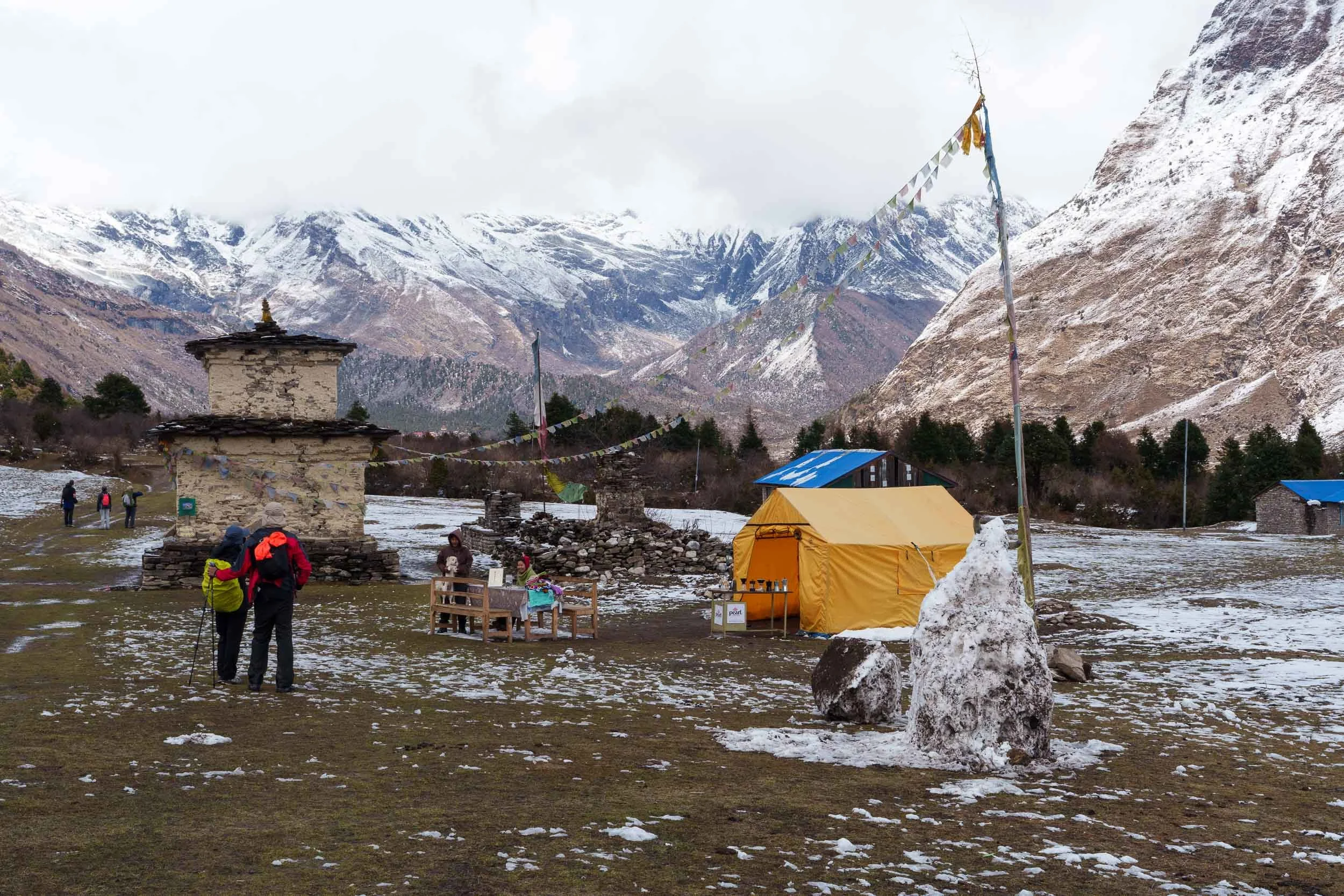
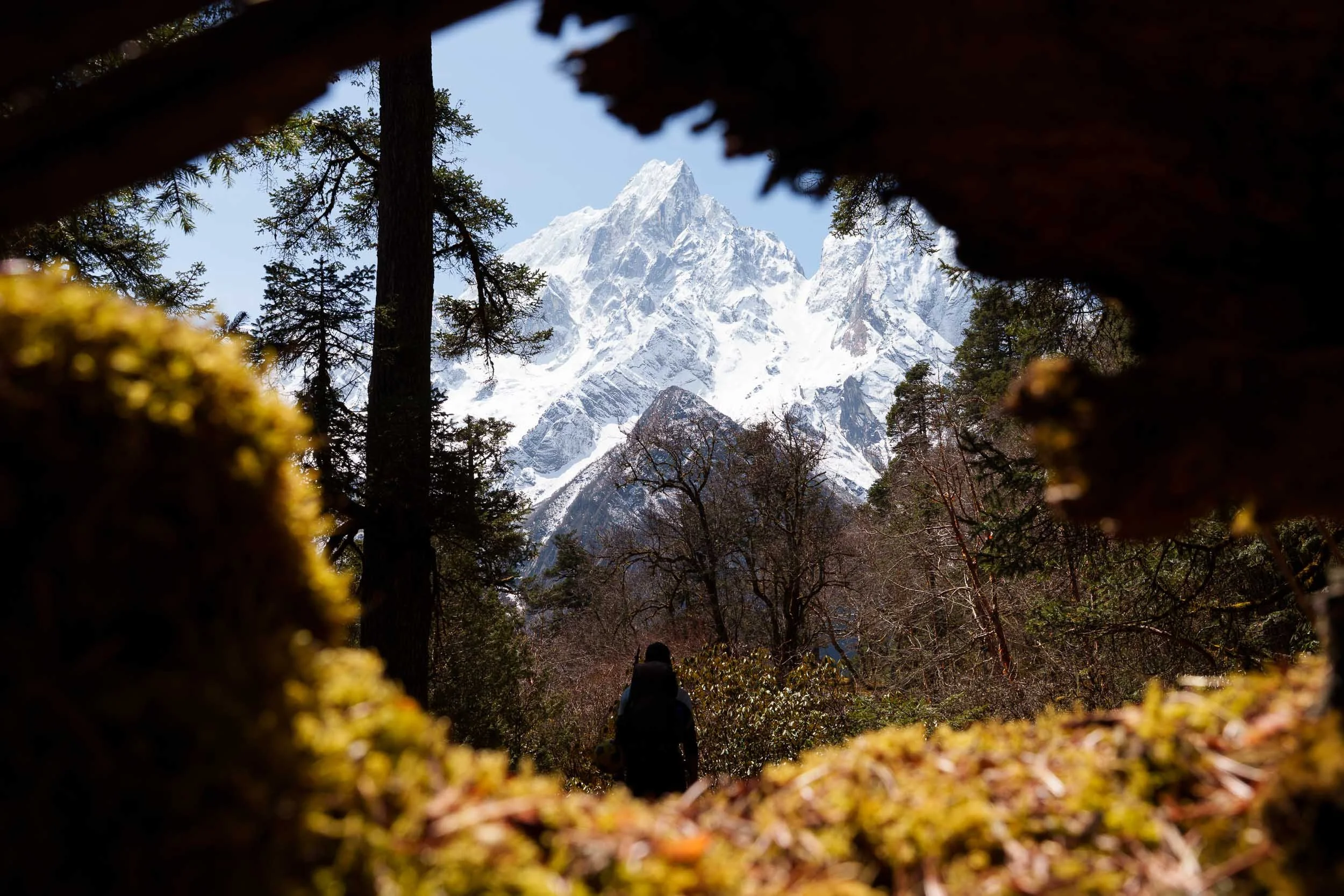
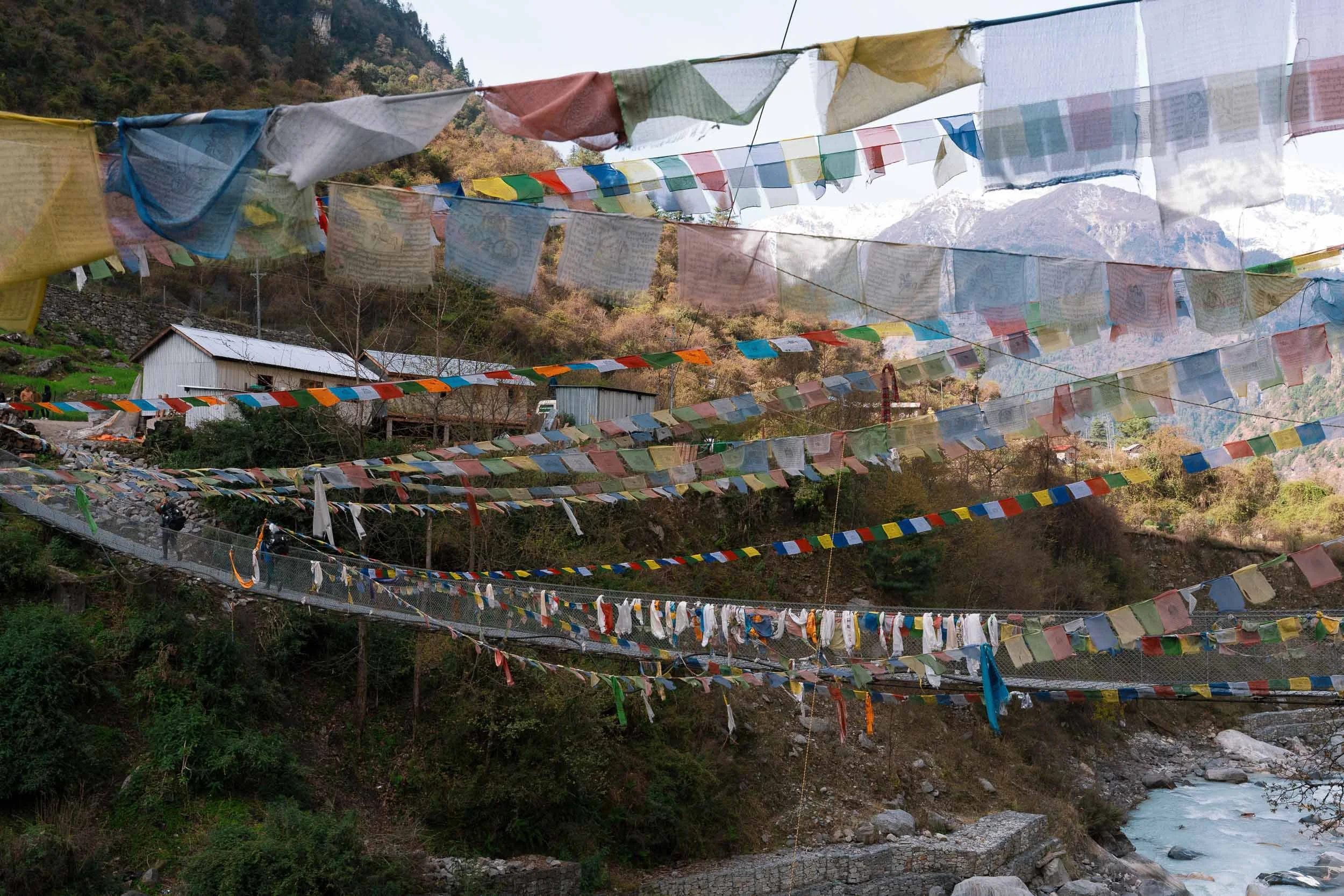
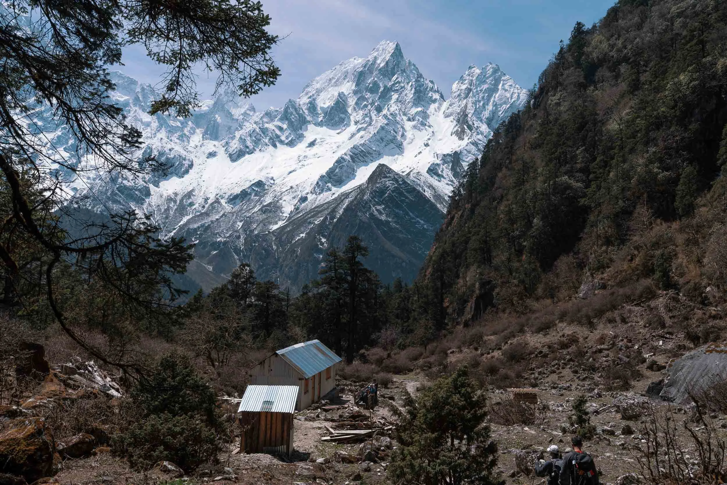
Day four was one of the most fascinating days of the trek, both culturally and visually. Not long after leaving Deng, we crossed the longest suspension bridge of the entire Manaslu Circuit. From here onwards, the region begins to feel noticeably more Tibetan. Mani walls, chortens, and prayer flags become common sights along the trail, while villages start to display traditional stone architecture that blends beautifully into the surrounding mountains. As we passed through villages such as Ranagaon and Bihi, we learned about local Buddhist customs. One important tradition is to always pass mani walls and chortens on the left side, moving clockwise as a sign of respect.
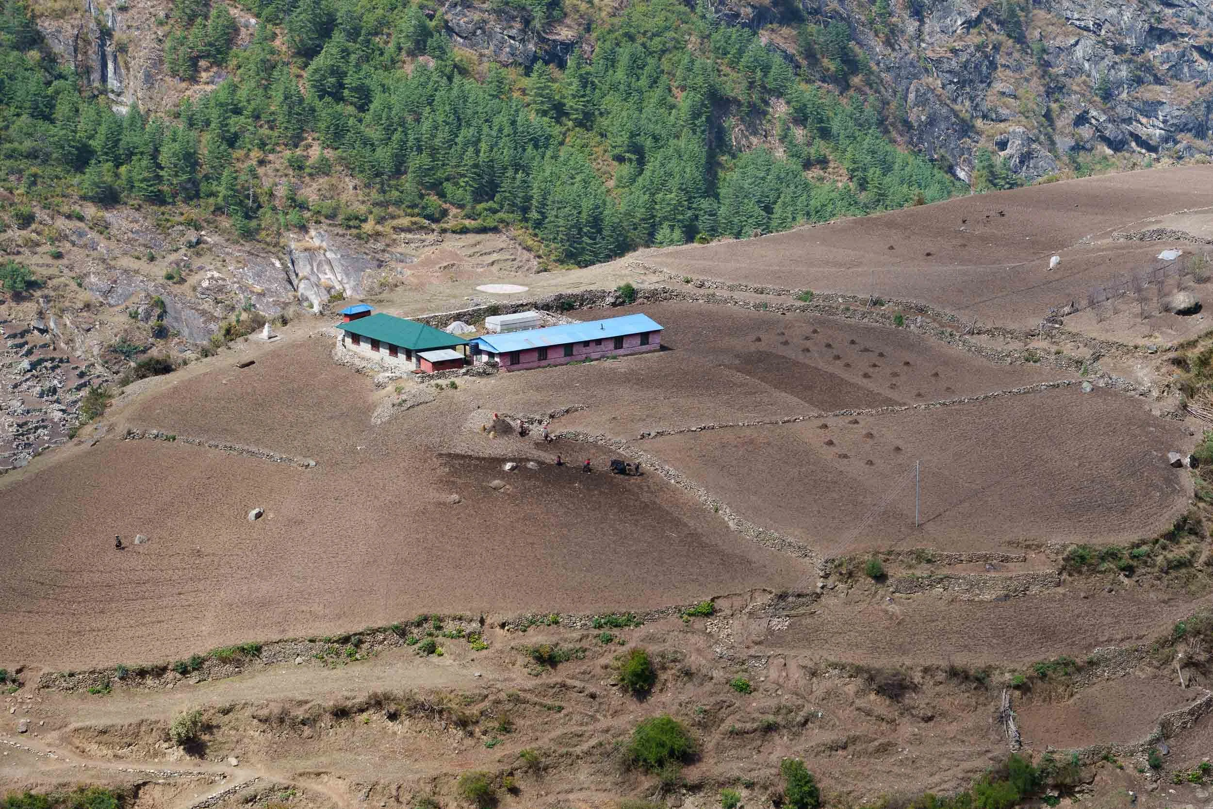
The valley is also home to ancient agricultural systems that have been used for generations. We saw terraced fields carved into steep hillsides where yaks and buffalo grazed among crops of millet and barley. The vegetation was equally interesting; we encountered peppercorn trees along the trail and even sampled a few fresh peppercorn berries straight from the branches.
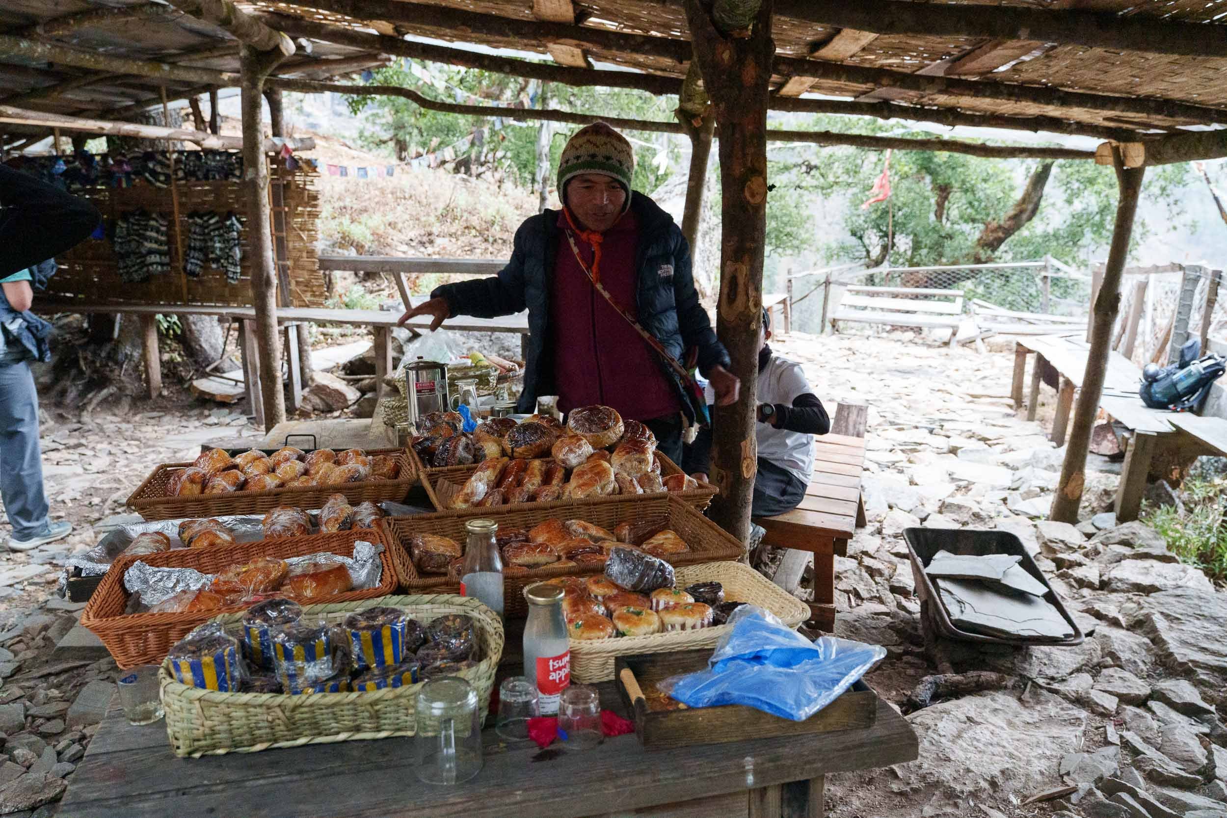
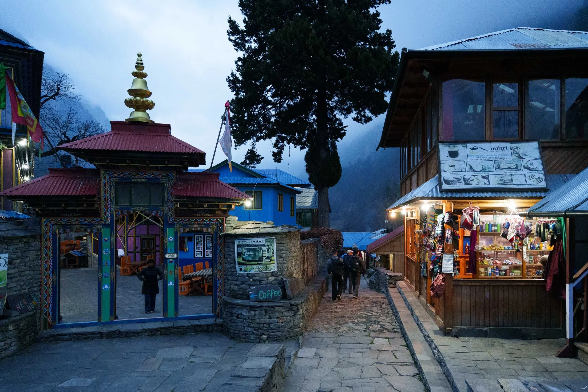
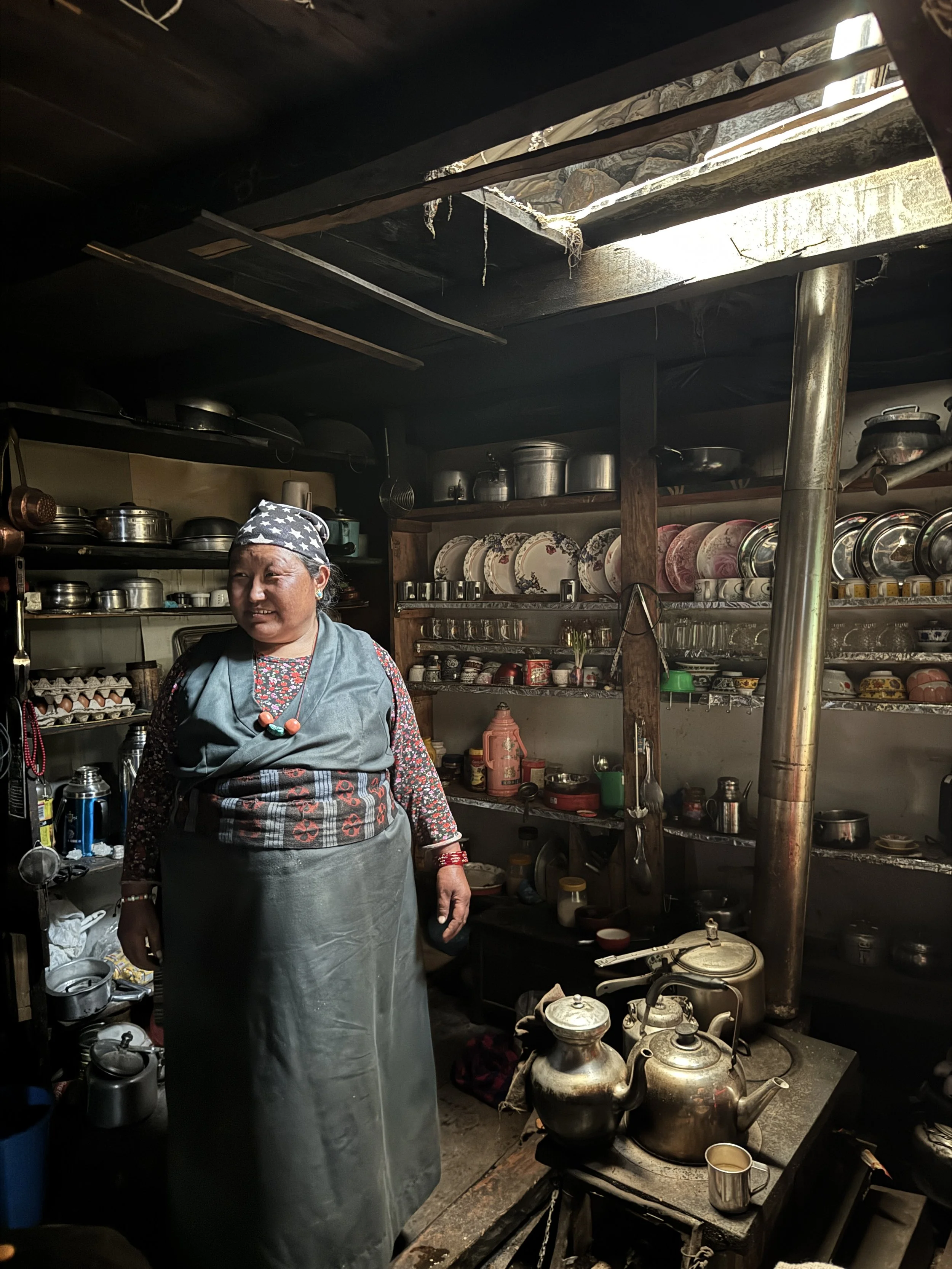
One of the day's most memorable viewpoints overlooked the Budhi Gandaki far below. The glacial river has carved dramatic rock formations into the valley, and we spent several minutes simply watching the milky blue water rush through the deep gorge. Just before reaching Namrung, we came across a large apple farm. After hours of walking, the fresh apple juice and homemade apple pie tasted incredible. We also spotted a troop of Nepal grey langurs hidden among the cliffs; without our guide, we would never have noticed them blending into the rocky landscape. Namrung has some of the nicest teahouses on the entire circuit, offering a comfortable place to rest before heading deeper into the mountains.
Plan Your Manaslu Trek Safely: The Manaslu Circuit is a restricted area that requires group permits and a licensed guide. We went with Royal Holidays Adventure for our trek and decided to partner with them because their safety standards, guide expertise, and logistics were excellent. Use code VIVKEV when contacting them to claim your exclusive 5%.
Day 5: Namrung to Shyala (3,460m / 11,351ft)
Hiking Distance: 12.9 km (8.0 miles)
Estimated Hiking Time: Around 8 hours
Elevation Gain: 1,010 m (3,313 feet)
Elevation Loss: 140 m (459 feet)
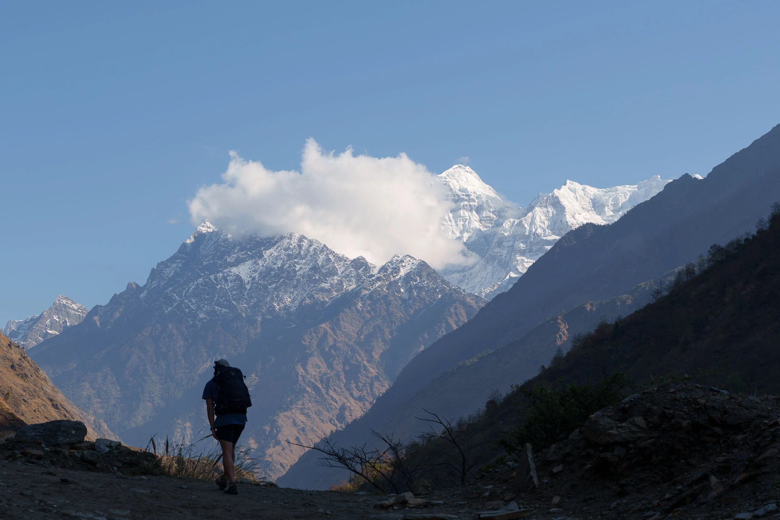
We woke up to one of the most beautiful sunrises of the entire trek. From our teahouse in Namrung, we watched the sky turn shades of pink and purple as the first light illuminated the snow-capped peaks at the end of the valley. Today's trek felt like a major turning point. The landscape, architecture, and culture all became increasingly Tibetan as we climbed higher into the Nubri Valley. Mani walls, prayer wheels, chortens, and intricately decorated gateway arches lined the trail.
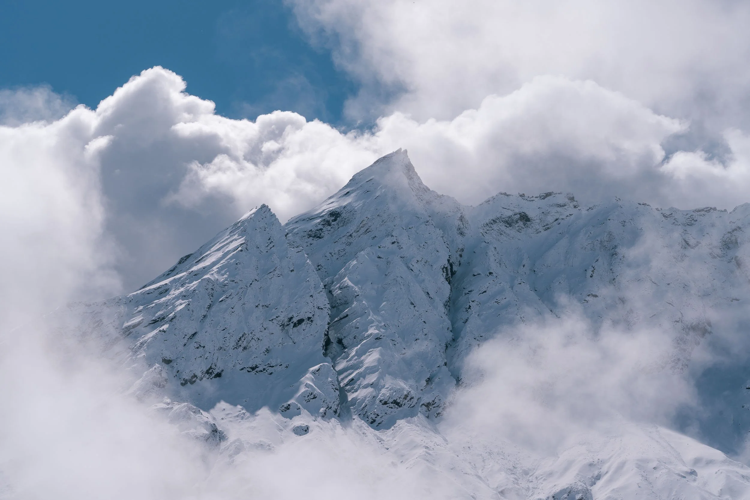
As we gained altitude, the air became noticeably cooler. Layers that had remained tucked away in our backpacks finally came out as we climbed past 3,000 meters. This is also the altitude where the thinner air becomes noticeable, and we found ourselves breathing harder on climbs and taking more frequent breaks. On a clear day, this is often the first opportunity to enjoy unobstructed views of Mount Manaslu. Unfortunately for us, the weather had other plans; rain began falling as we approached 3,000 meters and eventually turned into snow, hiding the mountain completely from view.
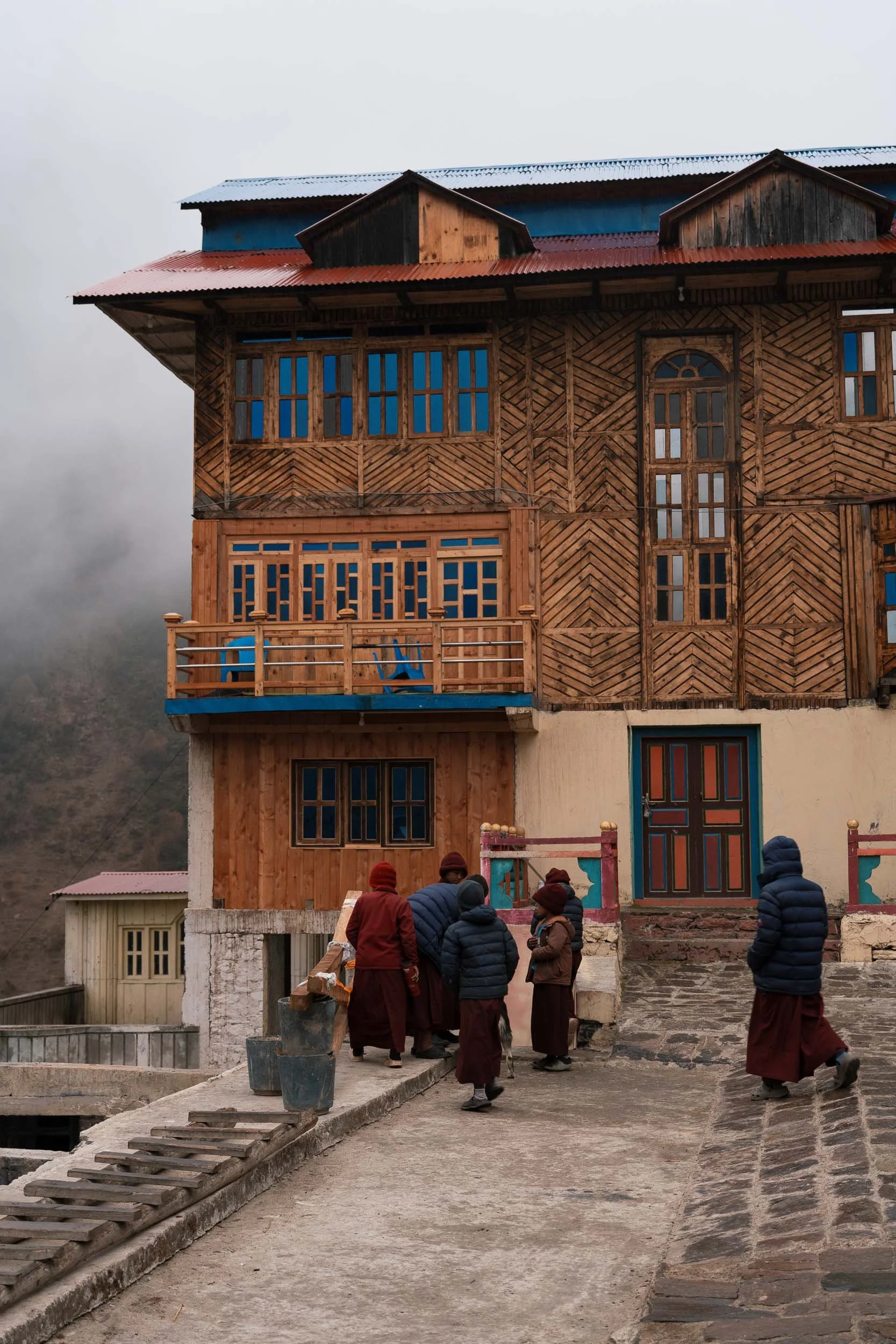
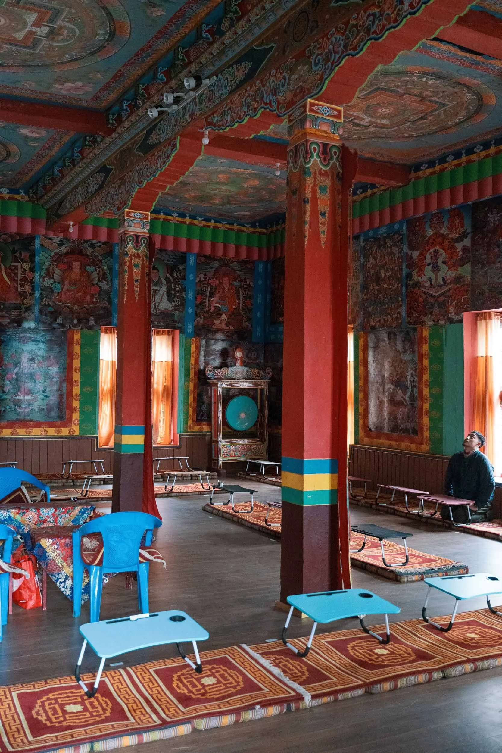
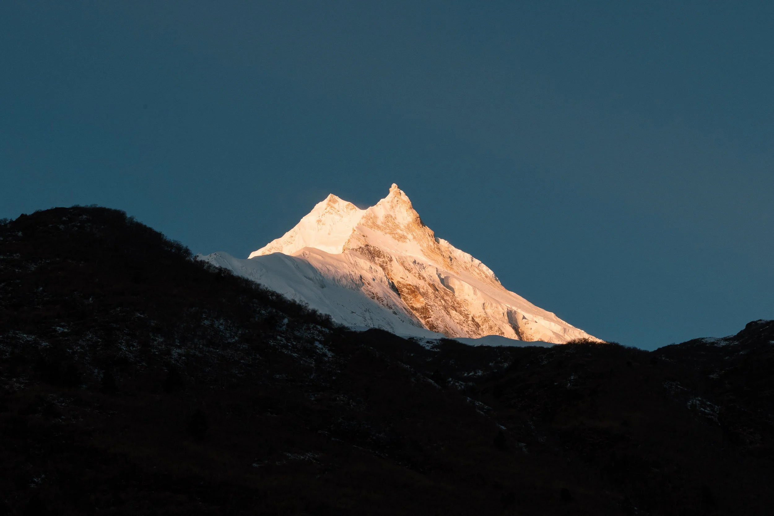
One of our favorite stops of the day was Ribum Monastery, located about 30 minutes above Lho village. The detour was well worth it. We arrived while young monk students were sitting exams, offering a fascinating glimpse into daily life within a Himalayan monastery. The final climb into Shyala was steep but rewarding. As we crested the last hill, we were greeted by one of the most spectacular villages on the entire trek. Surrounded by towering Himalayan giants, Shyala felt like a hidden world high in the mountains. Yaks, horses, and donkeys wandered freely through the village while prayer flags fluttered in the wind. On clear days, trekkers are rewarded with panoramic views of Mount Manaslu at 8,163m, Himal Chuli at 7,893m, and Ngadi Chuli at 7,871m.
Day 6: Shyala to Samagaun (3,510m / 11,515ft)
Hiking Distance: 4 km (2.5 miles) without side trip | 10.5 km (6.5 miles) with Pung Gyen Monastery side trip
Estimated Hiking Time: Around 5 hours including the side trip
Elevation Gain: 690 m (2,263 feet)
Elevation Loss: 100 m (328 feet)
After several long days of trekking, today's short direct distance felt almost luxurious. Before leaving Shyala, we visited the village monastery, which sits directly beneath the enormous face of Mount Manaslu. The setting is breathtaking, offering panoramic views of both the village and the surrounding peaks, many of which rise well above 7,500 meters.
Most trekkers head directly to Samagaun, but we chose to make a side trip to Pung Gyen Monastery, the largest monastery in the region. We attempted the hike ourselves but were forced to turn around when the weather deteriorated and visibility dropped. The previous night had brought heavy snowfall, transforming the landscape overnight. Everything was covered in a thick blanket of fresh snow, making the mountains feel even more dramatic and reminding us how quickly conditions can change in the Himalayas.
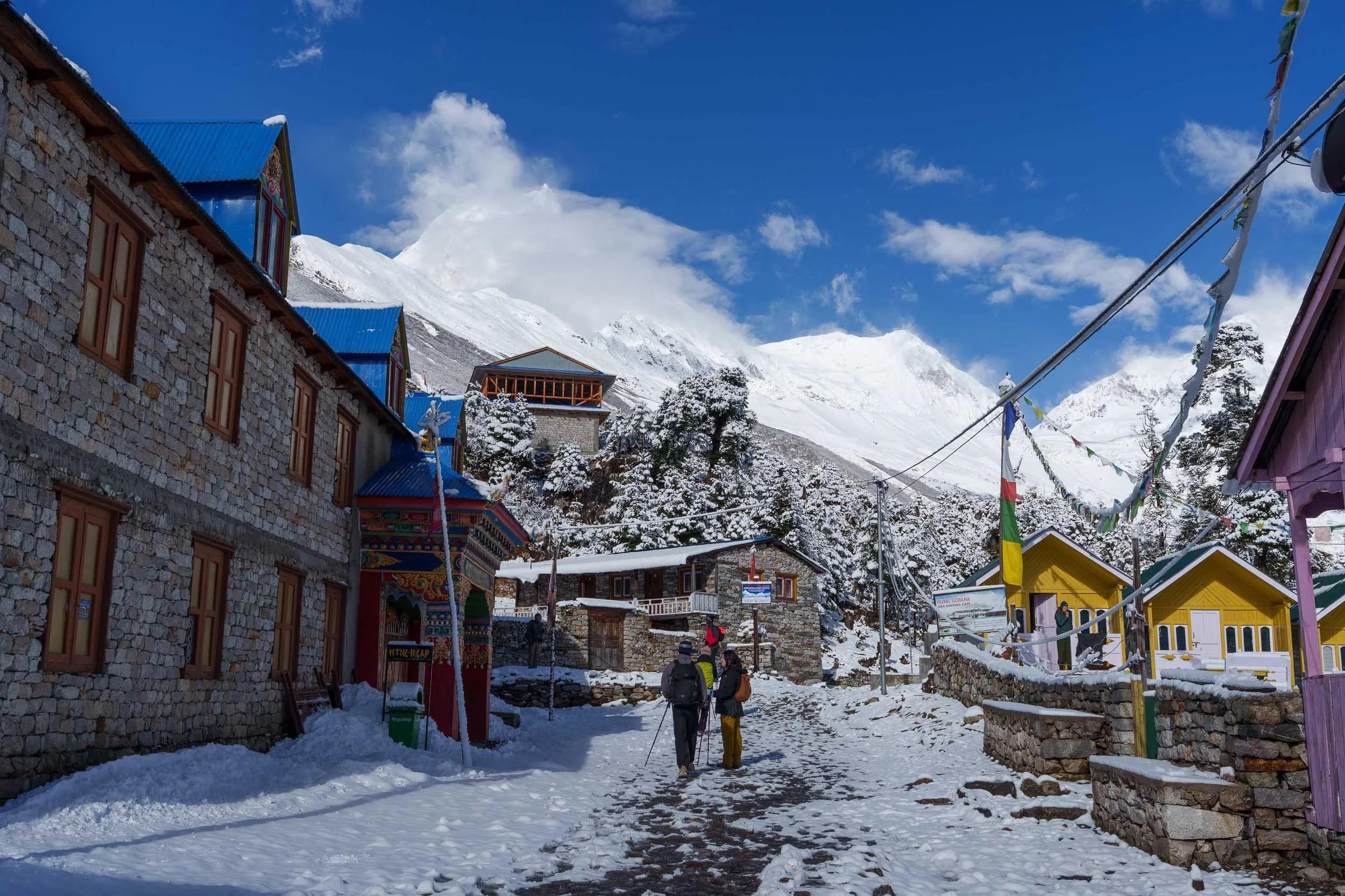
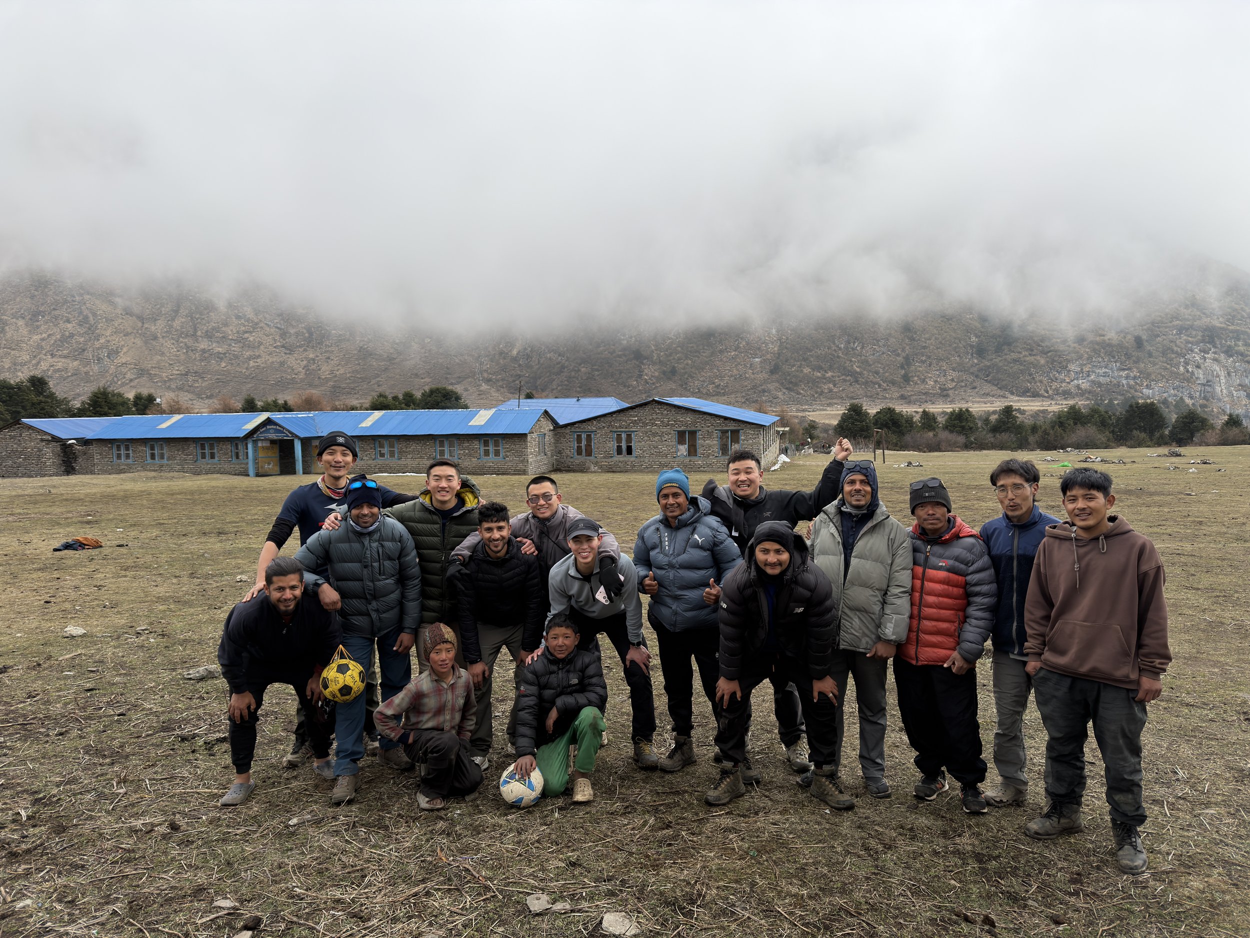
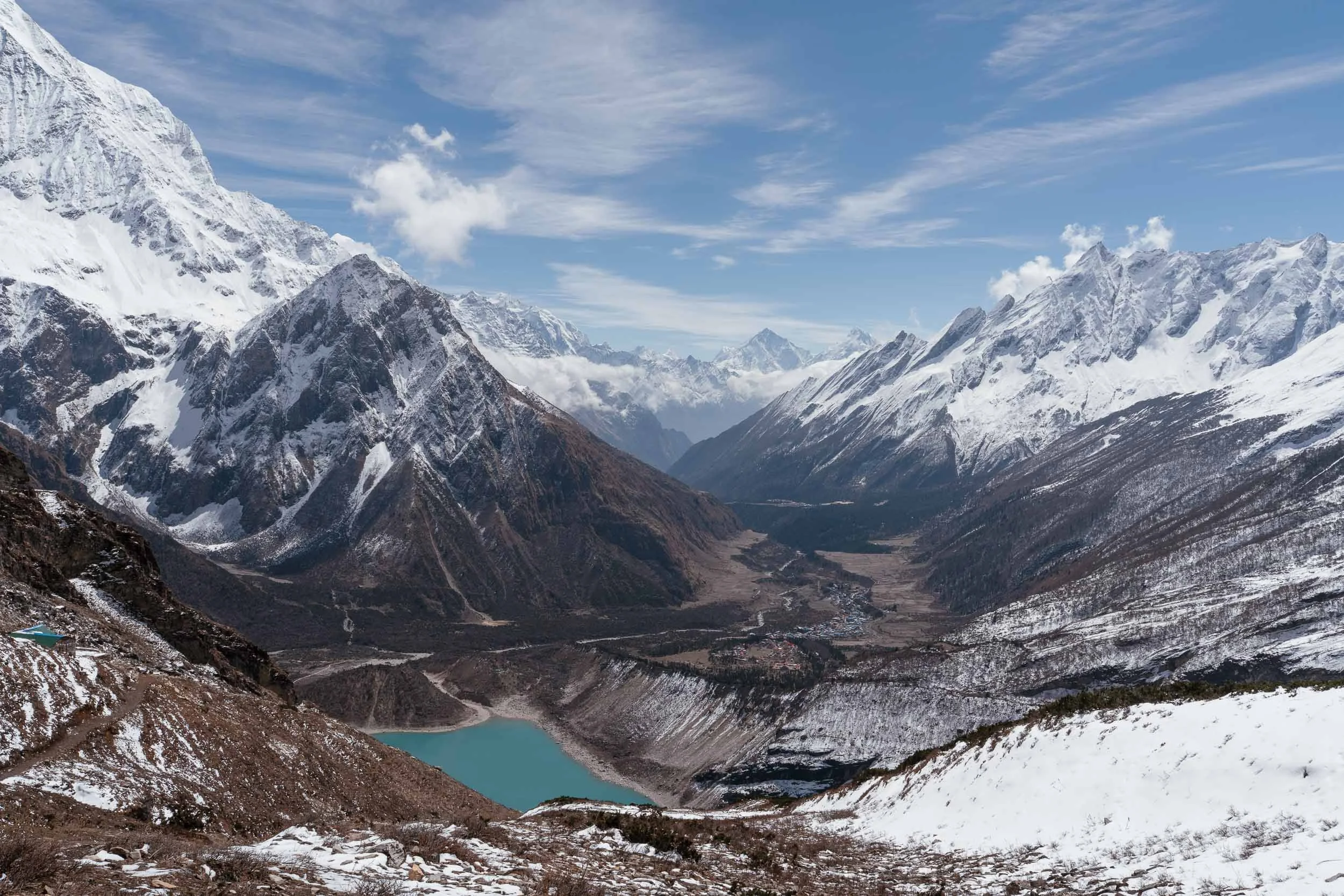
By lunchtime we had arrived in Samagaun, the largest settlement on the Manaslu Circuit before the crossing of Larke La Pass. Samagaun feels like a true mountain community with schools, shops, bakeries, lodges, and farms. Yaks roam freely among the stone houses, and traditional Tibetan culture remains strongly preserved here. In the afternoon, many trekkers visit nearby Birendra Lake, a beautiful glacial lake whose turquoise waters reflect the surrounding mountains when conditions are calm. We joined the local children, guides, and porters for a game of football on the pitch in front of the school. It became a core memory for all of us, showing how football can bring people together even when language gets in the way.
Day 7: Manaslu Base Camp (Acclimatization Day in Samagaun)
Hiking Distance: 15 km (9.3 miles) round trip
Estimated Hiking Time: Around 9 hours
Elevation Gain: 1,310 m (4,297 feet)
Elevation Loss: 1,310 m (4,297 feet)
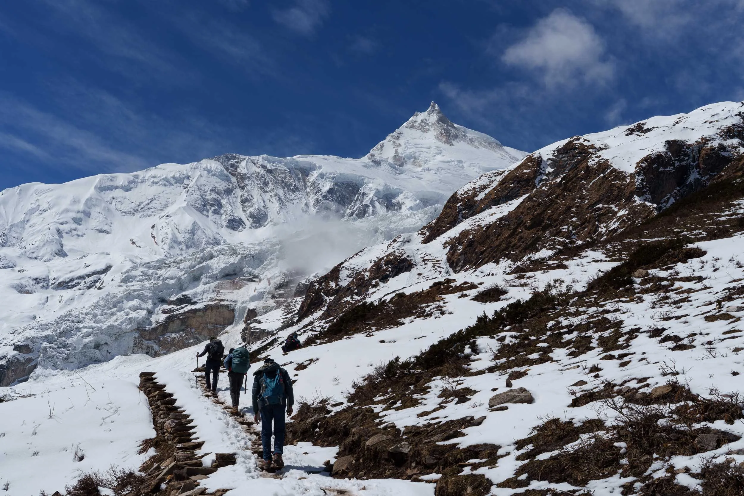
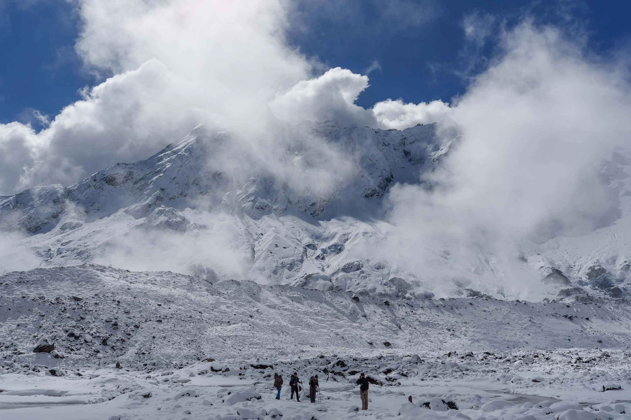
Today was our main acclimatization hike and one of the most anticipated days of the trek. During the autumn climbing season, this trail is filled with mountaineers attempting to summit Mount Manaslu, the eighth-highest mountain in the world at 8,163 meters. We visited during spring, outside the main expedition season, so the trail was much quieter.
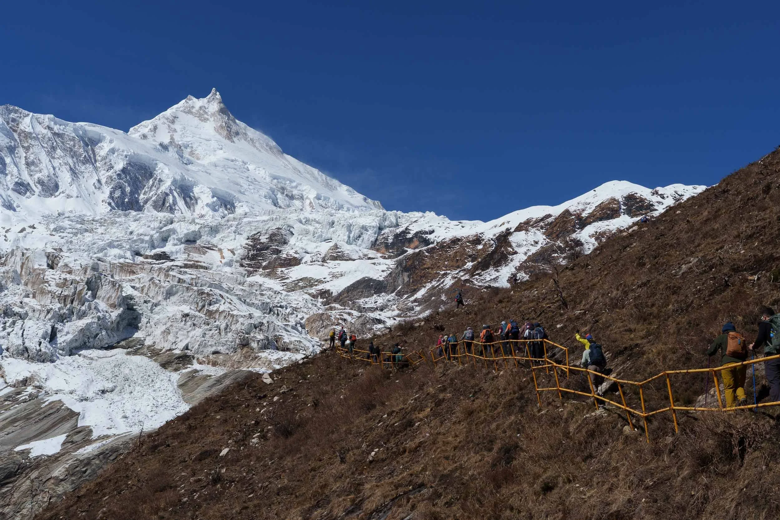
Unfortunately, several days of heavy snowfall had created dangerous avalanche conditions. Our original goal was to reach Manaslu Base Camp, but after witnessing multiple avalanches and assessing the risks, we made the sensible decision to turn back at around 4,350 meters. Although we did not reach base camp, the hike was still unforgettable.
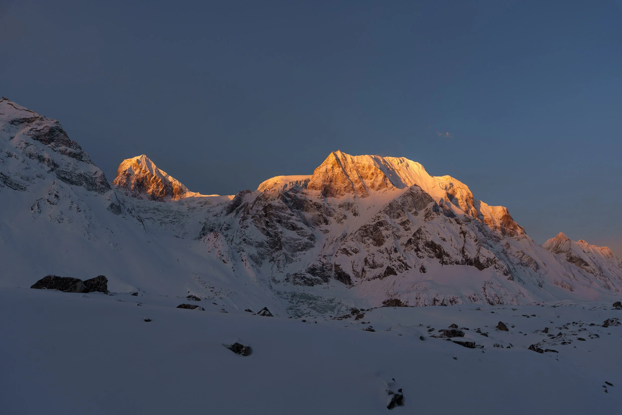
Shortly after leaving Samagaun, we passed Birendra Lake, whose striking turquoise waters stood out against the snowy landscape. As we climbed higher, the views became increasingly dramatic. Peaks such as Cheo Himal, Simnang Himal, Hiunchuli, and Mount Manaslu dominated the horizon, creating a breathtaking panorama that stretched in every direction. The altitude was becoming very noticeable by this point, and every uphill step required serious effort, but the scenery made every pause worthwhile. Back in Samagaun, watching the sun rise over Mount Manaslu the following morning became one of our favorite memories of the trek, with the first golden light illuminating the summit while the rest of the valley remained in shadow.
Day 8: Samagaun to Samdo (4,160m / 13,648ft)
Hiking Distance: 8.3 km (5.1 miles)
Estimated Hiking Time: Around 4 hours
Elevation Gain: 360 m (1,181 feet)
Elevation Loss: 10 m (33 feet)
Today was a relatively short and gentle trek, taking us around four hours to reach Samdo. The landscape above Samagaun feels completely different from the lower sections of the circuit. Trees have largely disappeared, replaced by wide-open alpine terrain and vast mountain views. There are no villages, shops, or toilet stops between Samagaun and Samdo, making this one of the most remote-feeling sections of the trek.
An important thing to note is that Samdo is effectively the last point where helicopter evacuations can realistically be arranged, and mobile reception becomes increasingly unreliable beyond this point. Despite the short distance, we took our time and enjoyed the spectacular scenery. Snow-capped peaks surrounded us throughout the day, and the sense of isolation grew stronger with every step.
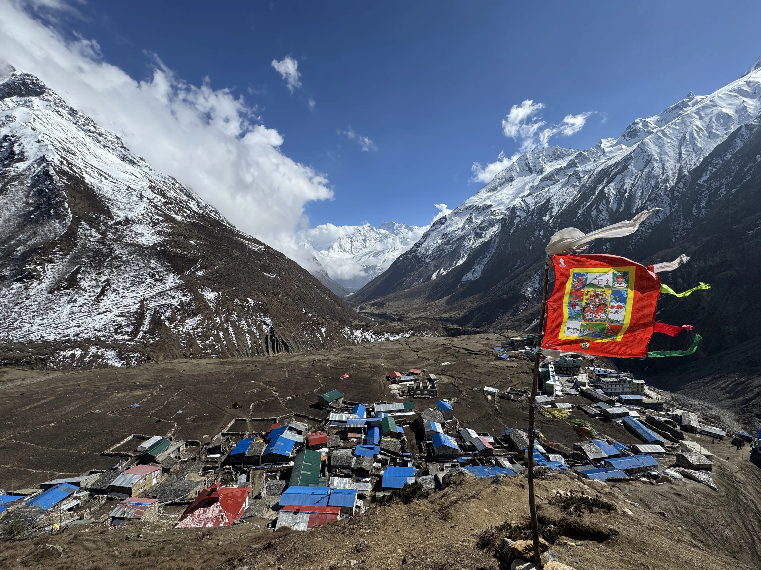
Samdo itself is a fascinating village. Settled by descendants of Tibetan refugees, it consists largely of traditional stone houses clustered beneath dramatic mountain slopes. Buddhism remains deeply woven into daily life, and yak herding continues to be the backbone of the local economy. For trekkers who did not complete the Manaslu Base Camp hike, an acclimatization climb to Samdo Ri at around 4,500m is often recommended in the afternoon.
Day 9: Samdo to Dharamsala (4,470m / 14,665ft)
Hiking Distance: 6.1 km (3.8 miles)
Estimated Hiking Time: Around 4 hours
Elevation Gain: 610 m (2,001 feet)
Elevation Loss: 10 m (33 feet)
Although today's distance was short, the altitude gain made it feel much harder than the numbers suggest. The air was noticeably thinner, and even gentle inclines required a slower, rhythmic pace. As we climbed higher, the mountains seemed to grow impossibly large around us, creating a constant reminder of just how small we were within this vast landscape.
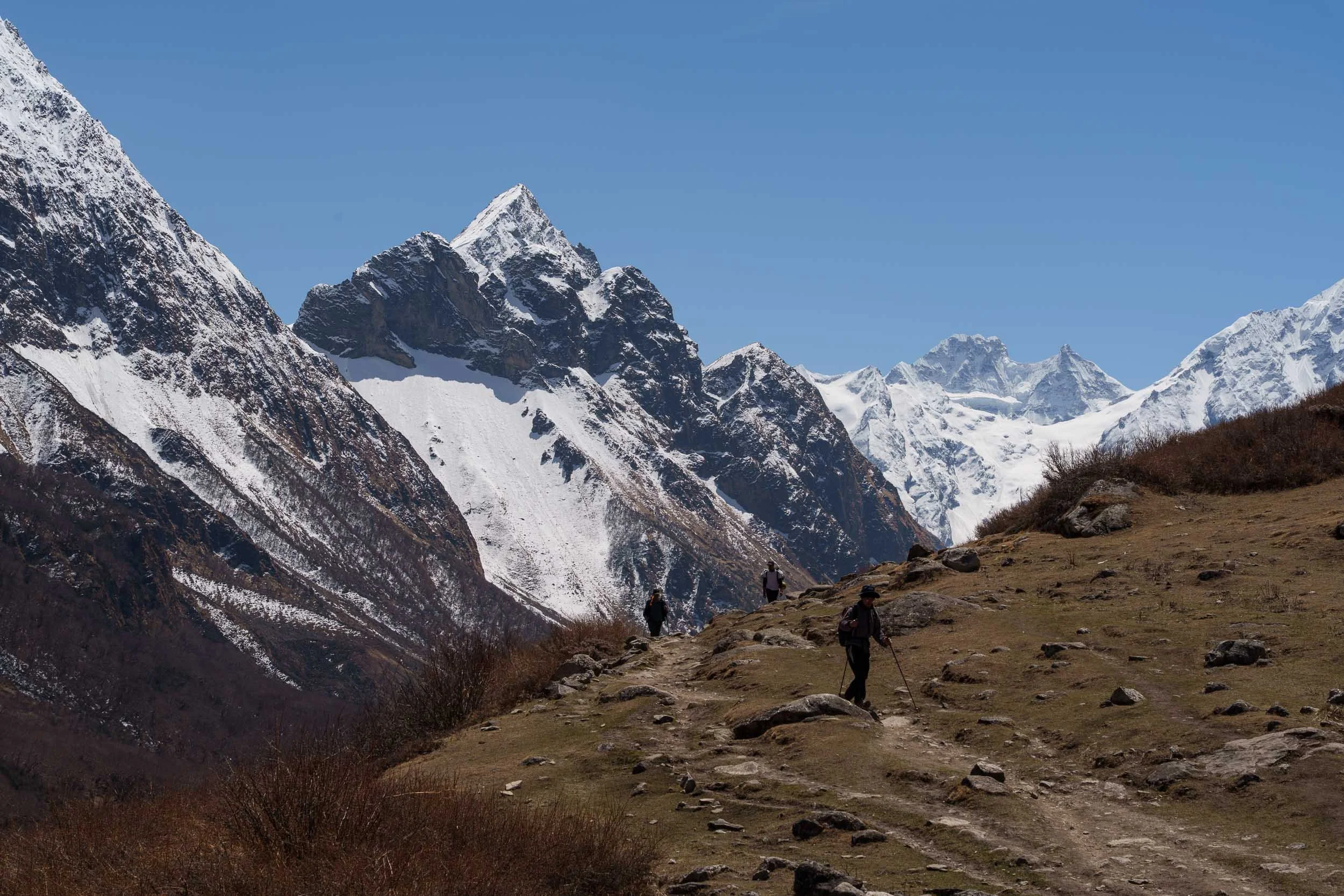
Along the way we passed Larke Bazaar, a seasonal Tibetan trading market that once played an important role in trade between Nepal and Tibet. Today it stands mostly empty outside the trading season, but it remains a fascinating historical landmark and marks the closest point of the trek to the Tibetan border. Wildlife sightings made the day particularly memorable; we spotted a herd of bharal, or Himalayan blue sheep, expertly navigating the rocky slopes above us, while yaks grazed peacefully across the alpine meadows.
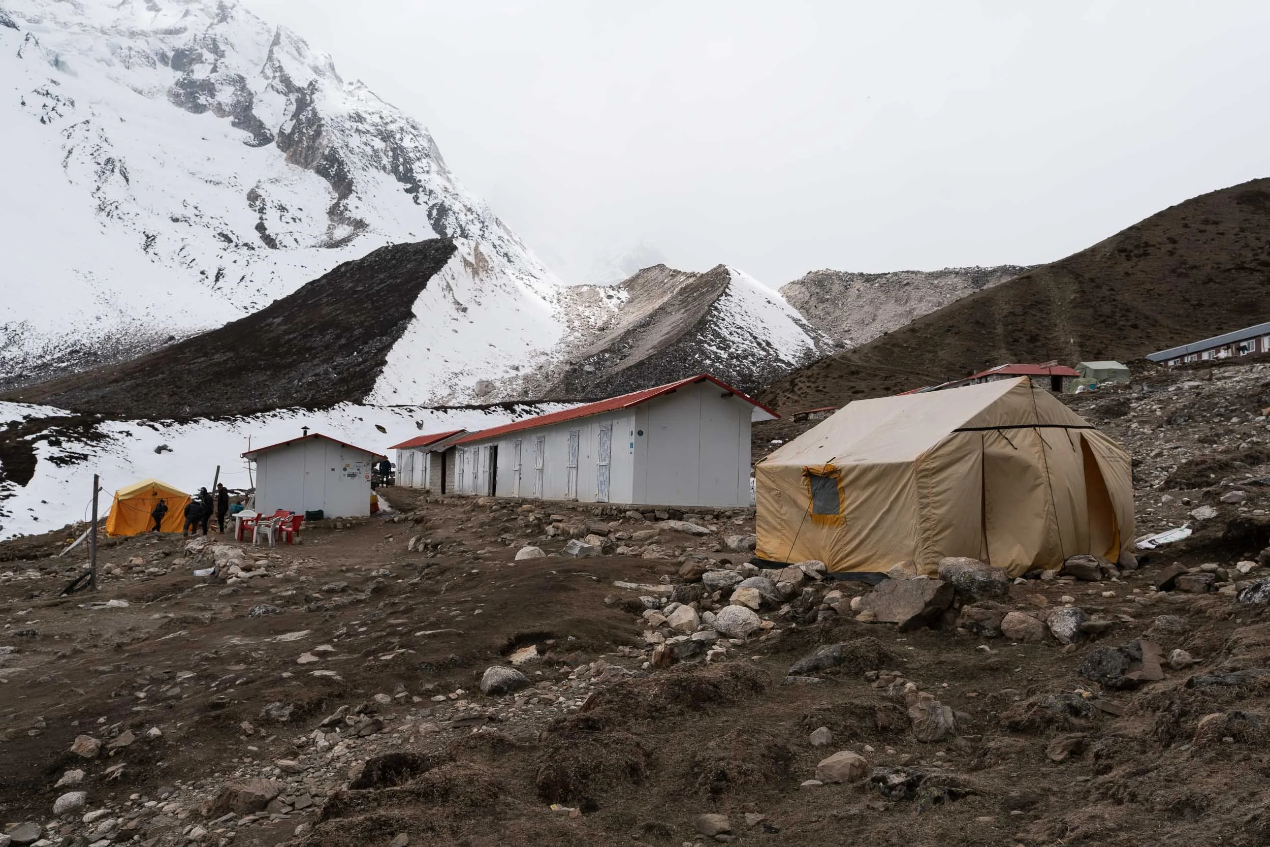
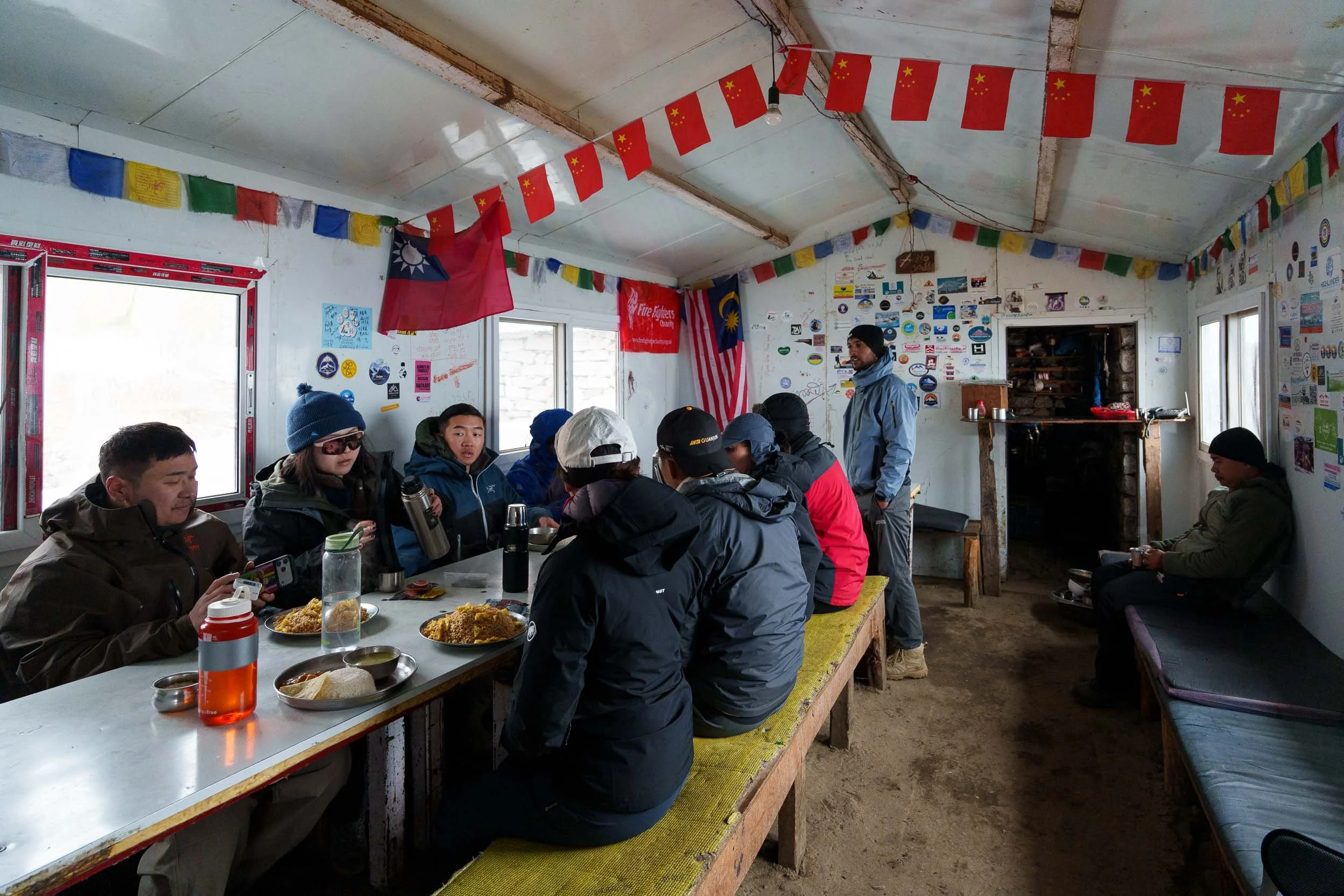
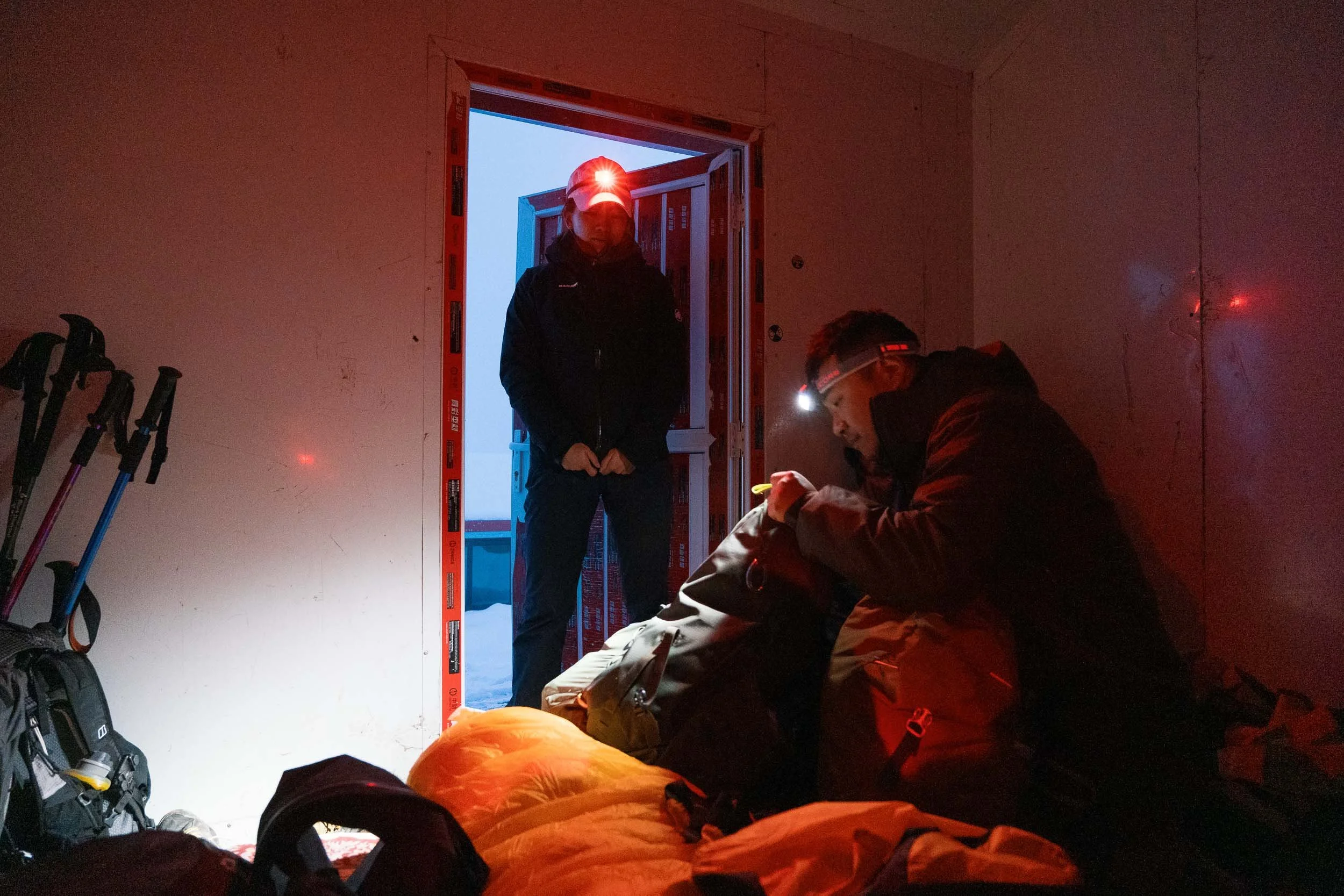
Dharamsala itself is less of a village and more of a high-altitude staging camp. There is no mobile reception, very limited facilities, and little to do beyond resting and preparing for the next day. Unlike previous nights where we could choose between multiple teahouses, there are only a couple of basic lodges here, meaning almost every trekker crossing Larke La Pass gathers in the same place. The atmosphere felt a little like base camp before a summit attempt. Everyone was organizing gear, checking weather forecasts, and discussing their plans for the following morning. The accommodation was very basic with no electricity, water frequently froze overnight, and we headed to bed around 7:00 pm knowing our alarms would be ringing at 2:00 am.
Day 10: Dharamsala to Bimthang (3,710m / 12,171ft) via Larke La Pass (5,106m / 16,752ft)
Hiking Distance: 15.4 km (9.5 miles)
Estimated Hiking Time: Around 12 hours
Elevation Gain: 680 m (2,230 feet)
Elevation Loss: 1,440 m (4,724 feet)
This was the day everything had been building towards. Our alarms rang at 2:00 am. By 3:00 am we were eating breakfast in the dark alongside dozens of other trekkers, all preparing for the biggest challenge of the circuit. Outside, the temperature was well below freezing. The stars were incredibly bright and the surrounding mountains glowed faintly beneath the moonlight. Even the bucket of water used to flush the toilet had frozen solid overnight.
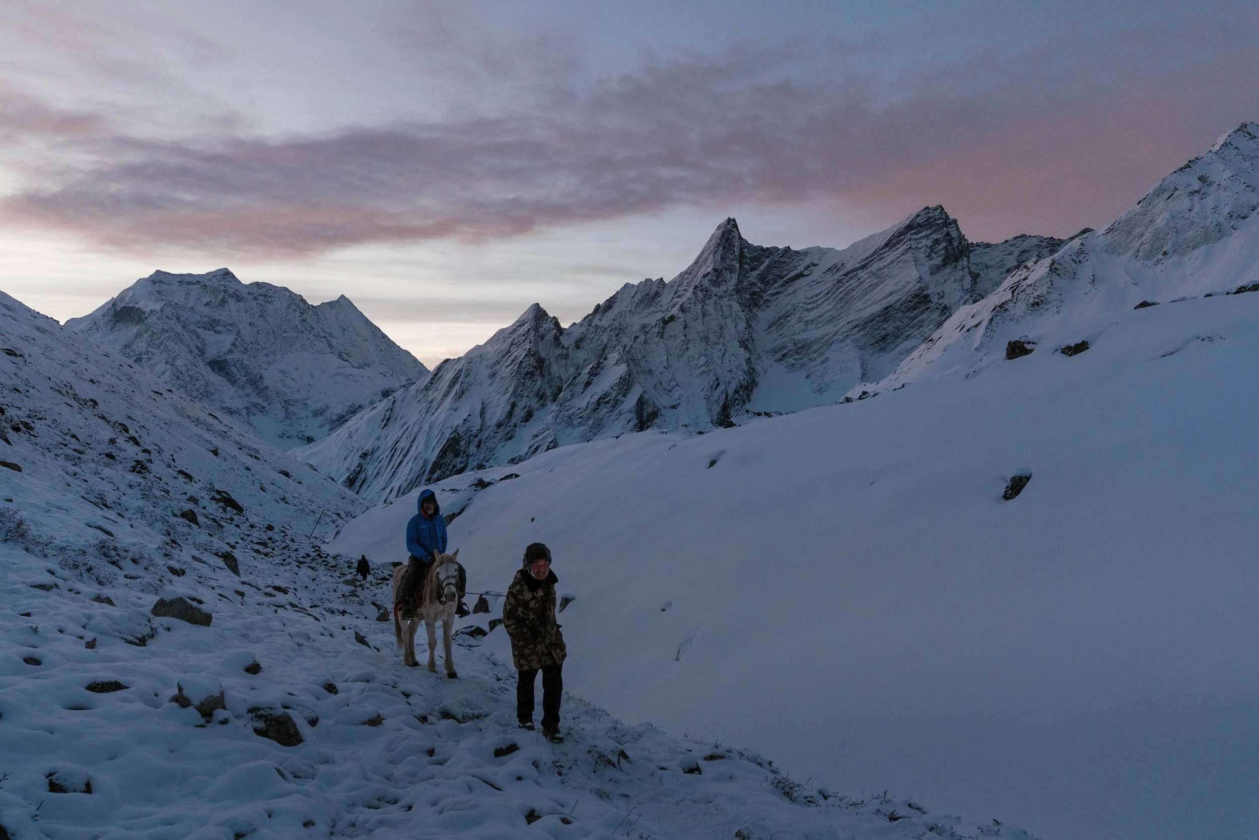
We began hiking shortly before 4:00 am, moving slowly through the darkness with only our headlamps lighting the way. Every step felt heavy. At over 4,500 meters, breathing became difficult and progress was slow but steady. As dawn approached, the sky gradually shifted through shades of blue, purple, and orange. One by one, the mountain peaks around us began catching the first rays of sunlight. It felt like watching a giant natural light show unfold across the Himalayas.
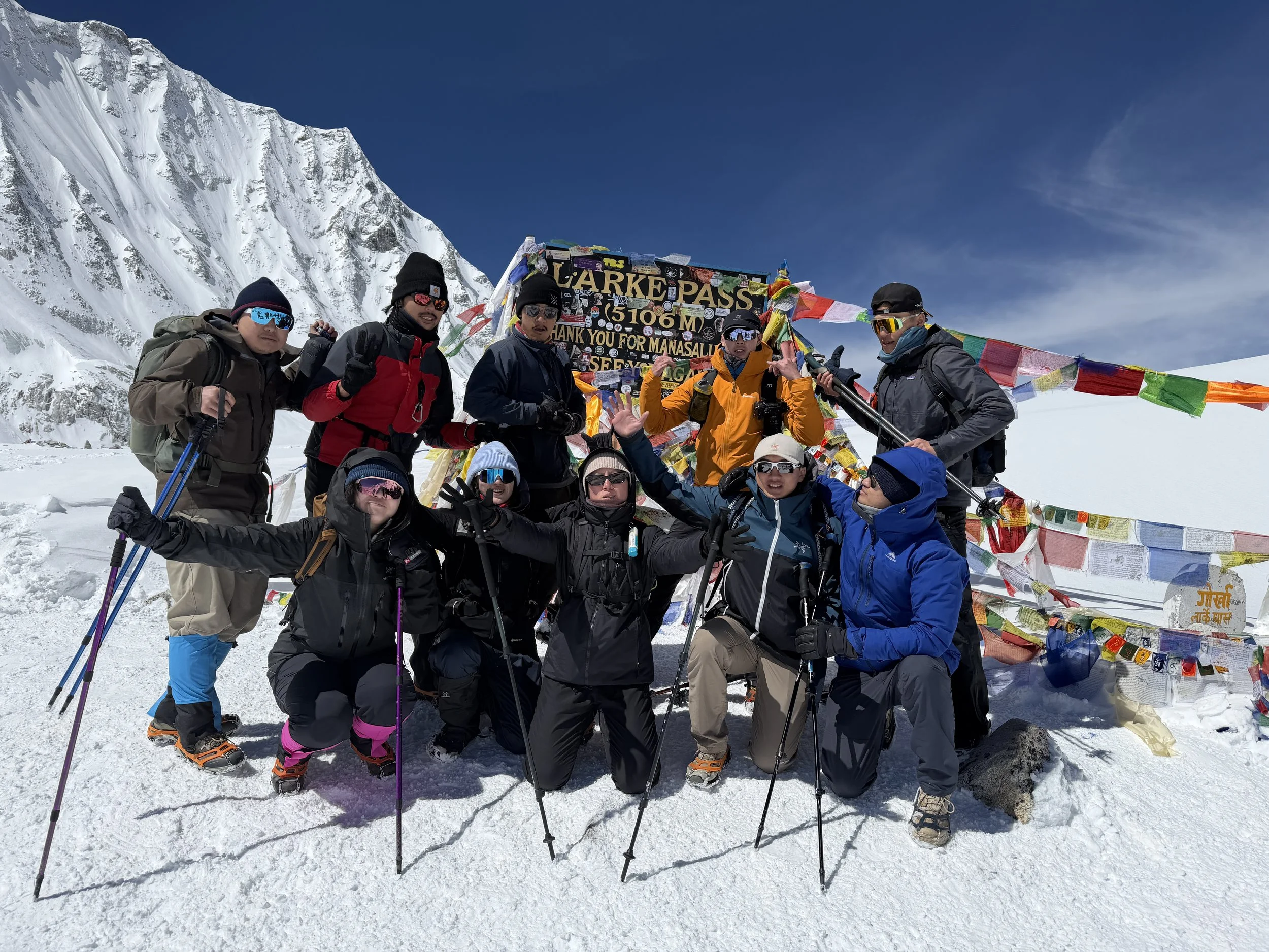
The trail to Larke La Pass is surprisingly gradual, but at this altitude nothing comes easily. Finally, after ten days of trekking, we reached Larke Pass at 5,106 meters. Standing there felt surreal. Looking back across the mountains we had spent over a week crossing, it was difficult to comprehend how far we had come. Reaching the highest point of the trek was not just physically rewarding, it was deeply emotional too.
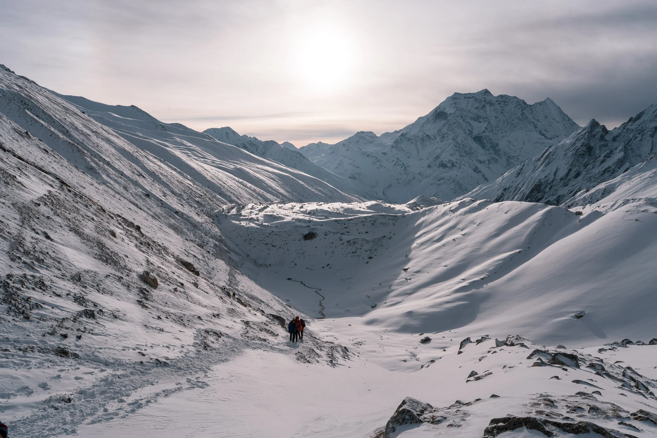
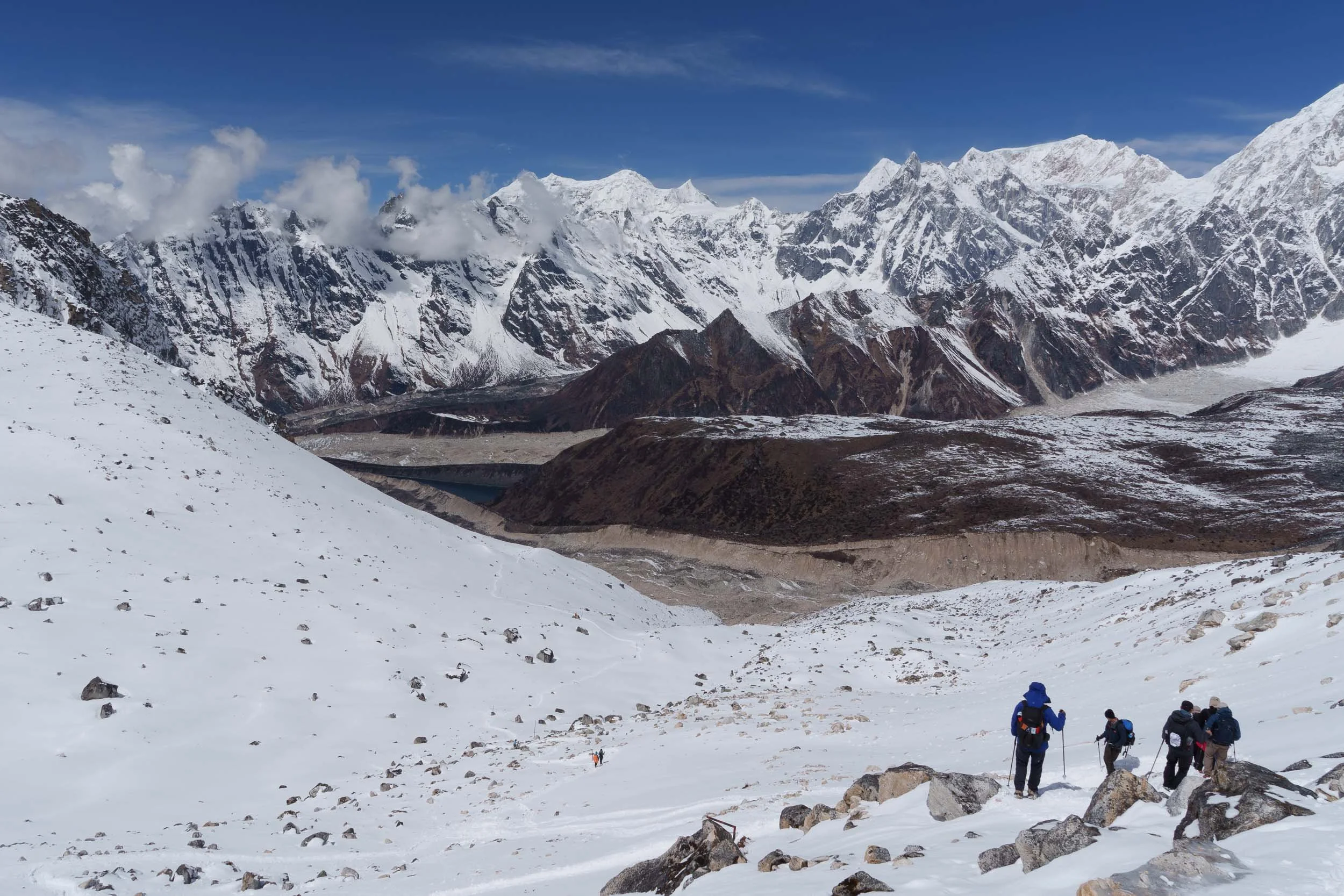
The celebration did not last long, however. The descent to Bimthang was still long and challenging. Snow and ice covered large sections of the trail, making microspikes and trekking poles invaluable. As we descended, entirely new mountain ranges came into view, including distant peaks of the Annapurna region. Arriving in Bimthang felt like stepping back into civilization. We had officially left the Buddhist non-violence zone and celebrated with our first meat dish in over a week, which was a simple chicken Dal Bhat that somehow became one of the most memorable meals of the entire trek.
Day 11: Bimthang to Goa (2,530m / 8,300ft)
Hiking Distance: 13.6 km (8.4 miles)
Estimated Hiking Time: Around 5 hours
Elevation Gain: 50 m (164 feet)
Elevation Loss: 1,220 m (4,002 feet)
After days spent trekking through barren alpine landscapes, today's descent felt like entering a completely different world. We followed the Dudh Khola, a milky glacial river that rushes down from the mountains. Gradually, snow-covered slopes gave way to forests, and patches of vibrant greenery began reappearing around us.
One of the most enjoyable parts of the day was watching the landscape transform. We passed through beautiful rhododendron and pine forests, crossed wooden bridges, and walked beneath towering trees that we had not seen for days. The pack animals also returned; after spending much of the upper trek surrounded only by yaks, we once again encountered long caravans of donkeys transporting supplies up and down the trail. Arriving in Goa, nestled among forests and farmland, felt far removed from the harsh high-altitude environment we had left behind only a day earlier.
Day 12: Goa to Kathmandu
Hiking Distance: 5.0 km (3.1 miles)
Estimated Hiking Time: Around 1.5 hours
Estimated Driving Time: Around 8 hours back to Kathmandu
The final day began with a short and relaxed walk to Tilche, taking about an hour and a half where our jeep was waiting. Compared to the dramatic mountain trails of previous days, the route felt almost effortless. We followed dirt roads and simple village paths, passing grazing sheep and enjoying our final few hours in the mountains.
Reaching the jeep marked the official end of our foot trek, but the journey back to Kathmandu was still far from over. The drive ended up taking around eight hours due to rough mountain dirt roads, traffic, and highway delays. As exhausting as the drive was, it gave us plenty of time to reflect on everything we had experienced over the previous twelve days. From deep river valleys and bamboo forests to ancient Buddhist villages, towering glaciers, and the crossing of Larke Pass, the Manaslu Circuit had exceeded every expectation.
For us, it was not just one of the most beautiful treks we have ever done, it was also one of the most culturally immersive. The combination of remote Himalayan landscapes and centuries-old Tibetan Buddhist traditions makes the Manaslu Circuit feel like a journey through a part of Nepal that still remains wonderfully untouched.
A Note on Our Route Planning
Our itinerary was mapped out for us by Royal Holidays Adventure. The daily pacing felt deliberate and smart. One of the main reasons we liked their approach was how they avoided some of the larger, busier trekkers’ villages. For example, they had us stay overnight in Shyala instead of the conventional stop at Lho. Shyala ended up being a stunning, movie-like village and one of our favorite spots on the whole circuit, plus it broke up the daily hiking distances evenly. Staying in these lesser-known villages meant we avoided the main crowds on some days and got to enjoy some actual peace at the end of a long walking day.
Alternative Itinerary and Extensions
For some trekkers, the first few days of the Manaslu Circuit Trek might be a bit more difficult due to long hiking distances in the first three days of the trek. The elevation gain in this lower part of the valley is relatively insignificant, but the distance could be considered long if you are not an experienced multi-day hiker. Some in our group who were completely new to trekking found these first few days the hardest part of the entire journey.
If you are concerned about your baseline endurance, speak to your tour operator to see if an alternative itinerary can be tailored for you. By breaking up the heavy distance days in the lower valley into shorter stages, you give your legs a much easier transition into the expedition. Here is our recommended alternative routing to soften the first three days:
-
Day 1 - Kathmandu to Jagat (Jeep day)
Day 2 - Jagat to Deng (18.7 km, ~9 hours)
Day 3 - Deng to Ghap (8.9 km, ~4 hours)
Day 4 - Ghap to Namrung (7.7 km, ~5 hours)
Day 5 - Namrung to Shyala (12.9 km, ~8 hours)
Day 6 - Shyala to Samagaun (10.5 km, ~5 hours)
Day 7 - Acclimatization at Samagaun
Optional: Birendra Lake Loop (5 km, ~2 hours)
Day 8 - Samagaun to Samdo (8.3 km, ~4 hours)
Day 9 - Samdo to Dharamsala (6.1 km, ~4 hours)
Day 10 - Dharamasarla to Bhimtang via Larke La Pass (15.4 km, ~12 hours)
Day 11 - Bimthang to Goa (13.6 km, ~5 hours)
Day 12 - Goa to Kathmandu (5km trek to Tilche, Jeep back to Kathmandu)
Tsum Valley Extension
If you have an extra 5 days to spare and want to get even further off the beaten track, ask your guide about adding the Tsum Valley Extension. This side trail branches off near Philim and takes you into an incredibly remote, deeply traditional Tibetan Buddhist valley that feels entirely frozen in time.
The Manaslu and Annapurna Circuit
If you are an experienced trekker with extra time in Nepal, you can combine two of the country's most famous routes into one epic journey. Instead of driving back to Kathmandu from Thoche on Day 12, you can branch directly onto the classic Annapurna Circuit trail.
However, this is a serious undertaking. Pushing onto the Annapurna Circuit means you will cross two separate high mountain passes over 5,000 meters; the Larke La Pass at 5,106 meters and the legendary Thorong La Pass at 5,416 meters. Along the way, the trail passes remote high alpine lakes, massive waterfalls, and sacred Buddhist monasteries. For any dedicated trekking enthusiast, combining these two circuits is the ultimate Himalayan challenge.
If you want to tackle this extended version, you will need to add an extra 8 to 10 days to your total itinerary. Be sure to let your trekking company know during your planning phase, as this extension requires additional trekking permits and specialized logistics to connect the two routes safely.
Final Thoughts
Looking back, the Manaslu Circuit was one of the most incredible and fruitful 12 days of our lives. The Manaslu Circuit is a demanding but rewarding route. It provides an authentic look at an untouched corner of the Himalayas where Tibetan culture and high peaks meet. You experience the massive mountain views and the physical challenge of the trail, but you also see exactly how the local communities live, work, and survive at high altitudes. It is a perspective you simply cannot get at home.
If you are ready to book this trek, we recommend organizing your trip with Royal Holidays Adventure. As a locally owned agency, Sandip and his team handle all the restricted area permit paperwork, arrange reliable transport, and provide experienced guides who track your safety at every altitude.
Because we partnered with them after our own journey, they have set up a discount for our readers. Use code VIVKEV or mention our blog when you contact them to get 5% off your booking.
Happy trekking!
Support Our Adventures!
Hi there! If you found our guides helpful, please consider using our affiliate links below when booking your next trip. It comes at no extra cost to you, but it helps us keep creating these resources. Thank you so much for your support!
Flights & Hotels: Book your stay with Trip.com
Car Rentals: Find the best rates via Discover Cars
Alltrails: Sign up with vivchow30 here to get 30% off today!
Have a specific question about your upcoming trek? Drop us an email or send a DM to @vivchowvals we’d love to help!
If you’ve enjoyed our content, you can treat us to a ‘virtual’ coffee here.